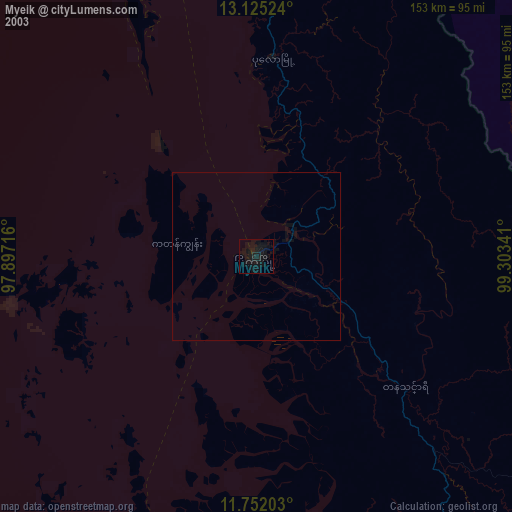
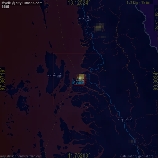
Myeik night lights from space
Night Light of Myeik (Tanintharyi) from space (Myanmar) Src. Average luminocity for 10x10km area is 12.0702% and for 50x50km: 0.5342%.
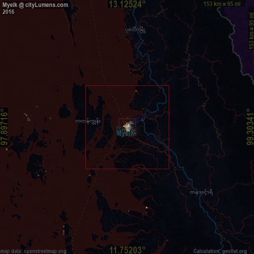

Analysis of Myeik night lights 2016
Square area 10x10 km:
 0%
0%90-99
0%80-89
2.48%70-79
1.65%60-69
1.03%50-59
3.1%40-49
4.13%30-39
5.79%20-29
2.48%10-19
0.41%0-9
78.93%Square area 50x50 km:
0%90-99
0%80-89
0.1%70-79
0.07%60-69
0.04%50-59
0.13%40-49
0.17%30-39
0.24%20-29
0.15%10-19
0.05%0-9
99.06%Clear (daylight) street map image can be seen on geolist.org.
Map coordinates:
13° 7' 30.9" North, 97° 53' 49.8" East
12° 26' 22.3" North, 98° 36' 1" East
11° 45' 7.3" North, 99° 18' 12.3" East
Some cities around Myeik sort by population:
• Hua Hin, TH
148.2 km =92.1 mi,  84°
84°
• Cha-am, TH
153.6 km =95.4 mi,  74°
74°
• Pran Buri, TH
141.4 km =87.9 mi,  92°
92°
• Tha Yang, TH
152.9 km =95 mi, 67°
• Prachuap Khiri Khan, TH
145.9 km =90.7 mi,  118°
118°
• Sam Roi Yot, TH
139.4 km =86.6 mi,  97°
97°
• Kui Buri, TH
141.9 km =88.2 mi,  106°
106°
• Khao Yoi, TH
159.8 km =99.3 mi,  56°
56°
1309611 (p: 173,298)
Sources (retrieved 2019-11-25):
» NASA, Earths city lights 1995
» NASA city lights 2003
» Earth at Night: Flat Maps 2012, 2016