Сопиште night lights from space
Night Light of Сопиште (Sopište) from space (North Macedonia) Src. Average luminocity for 10x10km area is 46.9048% and for 50x50km: 10.7492%.
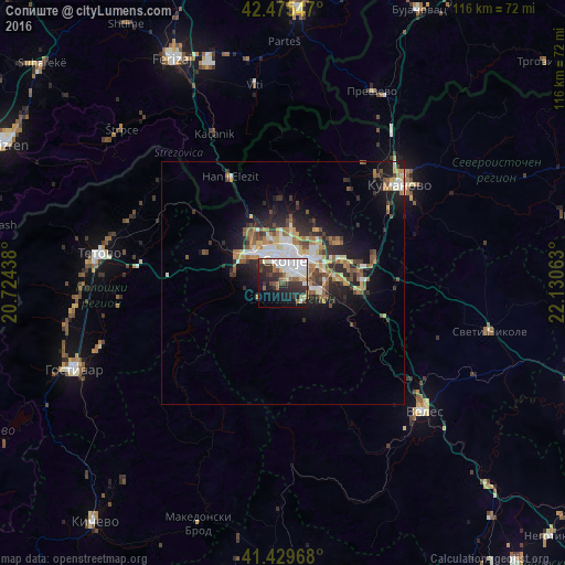
Analysis of Сопиште night lights 2016
Square area 10x10 km:
 11.11%
90-99
13.49%80-89
3.49%70-79
1.11%60-69
6.03%50-59
4.13%40-49
4.29%30-39
13.02%20-29
14.29%10-19
16.35%0-9
12.7%Square area 50x50 km:
1.49%90-99
2.06%80-89
1.1%70-79
1.04%60-69
1.87%50-59
1.44%40-49
1.54%30-39
1.81%20-29
3.24%10-19
6.18%0-9
78.24%Clear (daylight) street map image can be seen on geolist.org.
Map coordinates:
42° 28' 31.7" North, 20° 43' 27.8" East
41° 57' 17" North, 21° 25' 39" East
41° 25' 46.8" North, 22° 7' 50.3" East
Some cities around Сопиште sort by population:
• Skopje
4.7 km =2.9 mi,  3°
3°
• Čair
6.8 km =4.2 mi,  9°
9°
• Kisela Voda
6.3 km =3.9 mi,  95°
95°
• Gjorče Petro
8.5 km =5.3 mi,  313°
313°
• Butel
8.6 km =5.3 mi, 10°
• Šuto Orizare
9.5 km =5.9 mi,  358°
358°
• Studeničane
9.6 km =6 mi,  112°
112°
• Dračevo
8 km =5 mi, 104°
785679 (p: 9,460)
Sources (retrieved 2019-11-25):
» Earth at Night: Flat Maps 2012, 2016