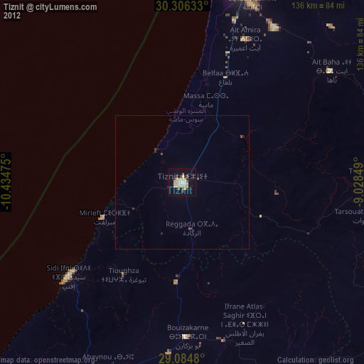
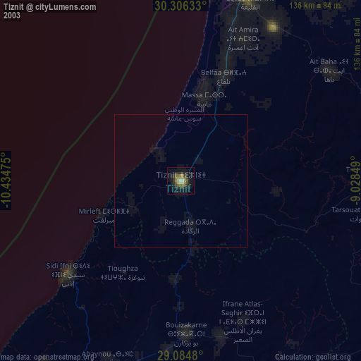
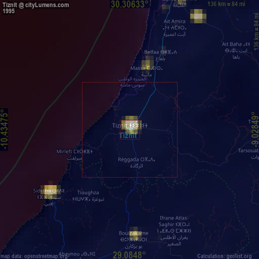
Tiznit night lights from space
Night Light of Tiznit (Souss-Massa) from space (Morocco) Src. Average luminocity for 10x10km area is 31.3056% and for 50x50km: 1.5091%.
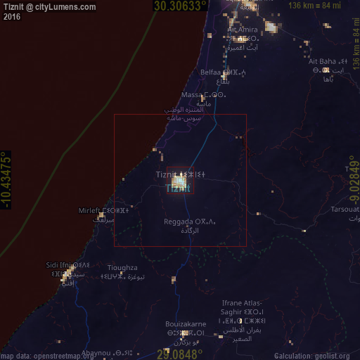
Analysis of Tiznit night lights 2016
Square area 10x10 km:
 4.56%
4.56%90-99
3.37%80-89
9.33%70-79
4.37%60-69
4.37%50-59
2.18%40-49
1.98%30-39
0.79%20-29
2.98%10-19
34.33%0-9
31.75%Square area 50x50 km:
0.17%90-99
0.13%80-89
0.35%70-79
0.17%60-69
0.2%50-59
0.08%40-49
0.24%30-39
0.14%20-29
0.14%10-19
1.43%0-9
96.95%Clear (daylight) street map image can be seen on geolist.org.
Map coordinates:
30° 18' 22.8" North, 10° 26' 5.1" West
29° 41' 50.7" North, 9° 43' 53.8" West
29° 5' 5.3" North, 9° 1' 42.6" West
Some cities around Tiznit sort by population:
• Agadir
81.4 km =50.6 mi,  9°
9°
• Guelmim
85.1 km =52.9 mi,  201°
201°
• Taroudant
118.9 km =73.9 mi,  43°
43°
• Oulad Teïma
92.4 km =57.4 mi,  32°
32°
• Tan-Tan
193.3 km =120.1 mi,  223°
223°
• Dakhla
81.1 km =50.4 mi, 12°
• Sidi Ifni
55.4 km =34.4 mi,  230°
230°
• Zag
191.1 km =118.7 mi,  167°
167°
2527089 (p: 55,092)
Sources (retrieved 2019-11-25):
» NASA, Earths city lights 1995
» NASA city lights 2003
» Earth at Night: Flat Maps 2012, 2016