Targuist night lights from space
Night Light of Targuist (Tanger-Tetouan-Al Hoceima) from space (Morocco) Src. Average luminocity for 10x10km area is 9.6978% and for 50x50km: 0.593%.
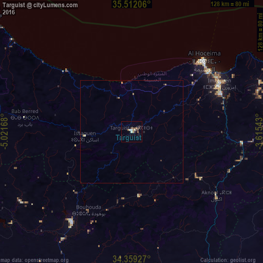
Analysis of Targuist night lights 2016
Square area 10x10 km:
 1.28%
1.28%90-99
0.92%80-89
0.73%70-79
0.92%60-69
2.01%50-59
2.2%40-49
1.65%30-39
3.3%20-29
0.18%10-19
0.92%0-9
85.9%Square area 50x50 km:
0.05%90-99
0.03%80-89
0.1%70-79
0.1%60-69
0.1%50-59
0.08%40-49
0.09%30-39
0.23%20-29
0.04%10-19
0.1%0-9
99.07%Clear (daylight) street map image can be seen on geolist.org.
Map coordinates:
35° 30' 43.4" North, 5° 1' 18" West
34° 56' 15.7" North, 4° 19' 6.8" West
34° 21' 33.4" North, 3° 36' 55.5" West
Some cities around Targuist sort by population:
• Al Hoceïma
49.2 km =30.6 mi,  44°
44°
• Taza
85.7 km =53.3 mi,  160°
160°
• Tirhanimîne
46.9 km =29.1 mi, 44°
• Imzouren
48.5 km =30.1 mi,  61°
61°
• Chefchaouene
89.8 km =55.8 mi,  286°
286°
• Taounate
53.4 km =33.2 mi,  213°
213°
• Bni Bouayach
47.4 km =29.5 mi,  66°
66°
• Midar
71.6 km =44.5 mi,  89°
89°
2529872 (p: 11,560)
Sources (retrieved 2019-11-25):
» Earth at Night: Flat Maps 2012, 2016