Sale night lights from space
Night Light of Sale (Rabat-Salé-Kénitra) from space (Morocco) Src. Average luminocity for 10x10km area is 73.5979% and for 50x50km: 20.6862%.
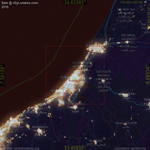
Analysis of Sale night lights 2016
Square area 10x10 km:
 21.68%
90-99
21.33%80-89
9.27%70-79
12.76%60-69
11.36%50-59
1.92%40-49
1.57%30-39
4.55%20-29
9.44%10-19
5.59%0-9
0.52%Square area 50x50 km:
4.04%90-99
3.71%80-89
2.59%70-79
2.54%60-69
4.08%50-59
2.24%40-49
1.9%30-39
2.85%20-29
5.43%10-19
9.58%0-9
61.03%Clear (daylight) street map image can be seen on geolist.org.
Map coordinates:
34° 38' 1.1" North, 7° 30' 5.7" West
34° 3' 11.2" North, 6° 47' 54.5" West
33° 28' 6.8" North, 6° 5' 43.2" West
Some cities around Sale sort by population:
• Rabat
5.4 km =3.4 mi,  215°
215°
• Kenitra
30.6 km =19 mi,  40°
40°
• Temara
17.1 km =10.6 mi, 215°
• Mohammedia
67.7 km =42.1 mi,  232°
232°
• Tiflet
48.7 km =30.3 mi,  111°
111°
• Skhirate
31 km =19.3 mi, 223°
• Sidi Yahia El Gharb
53.4 km =33.2 mi,  58°
58°
• Bouznika
44.4 km =27.6 mi, 228°
2537763 (p: 903,485)
Sources (retrieved 2019-11-25):
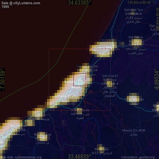
» NASA, Earths city lights 1995
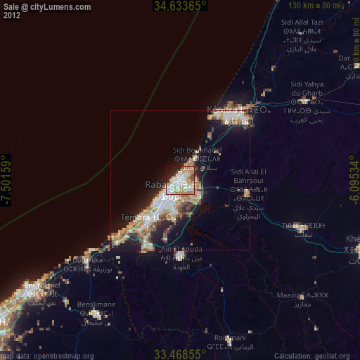
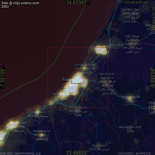
» NASA city lights 2003
» Earth at Night: Flat Maps 2012, 2016