Oued Zem night lights from space
Night Light of Oued Zem (Béni Mellal-Khénifra) from space (Morocco) Src. Average luminocity for 10x10km area is 23.5641% and for 50x50km: 4.141%.
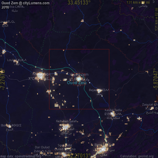
Analysis of Oued Zem night lights 2016
Square area 10x10 km:
 3.85%
3.85%90-99
4.21%80-89
3.66%70-79
1.47%60-69
1.65%50-59
3.3%40-49
2.75%30-39
2.56%20-29
2.75%10-19
24.18%0-9
49.63%Square area 50x50 km:
0.34%90-99
0.42%80-89
0.89%70-79
0.36%60-69
0.65%50-59
0.29%40-49
0.58%30-39
0.65%20-29
0.46%10-19
1.32%0-9
94.05%Clear (daylight) street map image can be seen on geolist.org.
Map coordinates:
33° 27' 4.8" North, 7° 16' 36.2" West
32° 51' 45.7" North, 6° 34' 24.9" West
32° 16' 12.5" North, 5° 52' 13.7" West
Some cities around Oued Zem sort by population:
• Khouribga
31.1 km =19.3 mi,  273°
273°
• Beni Mellal
62.1 km =38.6 mi,  160°
160°
• Settat
98.5 km =61.2 mi,  278°
278°
• Al Fqih Ben Çalah
41.5 km =25.8 mi,  194°
194°
• Khenifra
85.5 km =53.1 mi,  84°
84°
• Kasba Tadla
41 km =25.5 mi,  135°
135°
• Oulmes
82.2 km =51.1 mi,  40°
40°
• Boujniba
19.2 km =11.9 mi, 282°
2540689 (p: 84,910)
Sources (retrieved 2019-11-25):
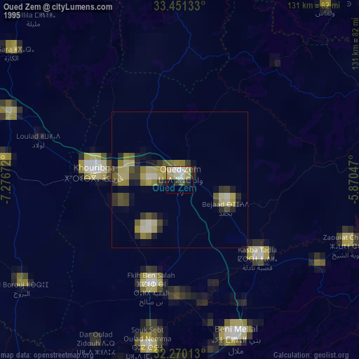
» NASA, Earths city lights 1995
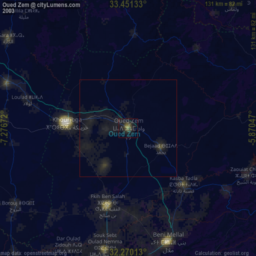
» NASA city lights 2003
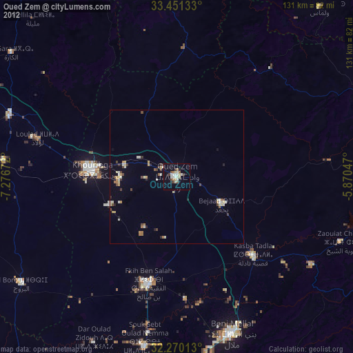
» Earth at Night: Flat Maps 2012, 2016