Belvaux night lights from space
Night Light of Belvaux (Esch-sur-Alzette) from space (Luxembourg) Src. Average luminocity for 10x10km area is 57.6064% and for 50x50km: 24.5287%.
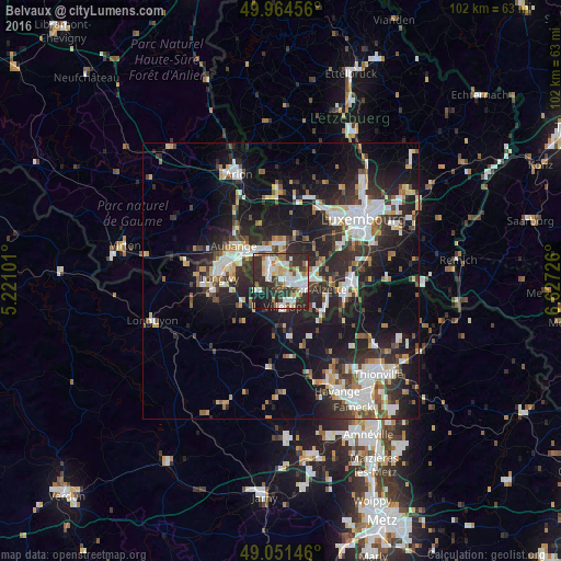
Analysis of Belvaux night lights 2016
Square area 10x10 km:
 13.87%
90-99
13.59%80-89
7.98%70-79
4.76%60-69
5.18%50-59
4.34%40-49
7.28%30-39
10.78%20-29
25.35%10-19
6.86%0-9
0%Square area 50x50 km:
4.68%90-99
4.71%80-89
2.53%70-79
2.14%60-69
2.04%50-59
2.56%40-49
2.87%30-39
4.08%20-29
10.41%10-19
18.22%0-9
45.77%Clear (daylight) street map image can be seen on geolist.org.
Map coordinates:
49° 57' 52.4" North, 5° 13' 15.6" East
49° 30' 36.5" North, 5° 55' 26.9" East
49° 3' 5.3" North, 6° 37' 38.1" East
Some cities around Belvaux sort by population:
• Esch-sur-Alzette
4.4 km =2.7 mi,  111°
111°
• Aubange, BE
10.6 km =6.6 mi,  306°
306°
• Villerupt, FR
4.8 km =3 mi,  173°
173°
• Mont-Saint-Martin, FR
10.8 km =6.7 mi,  290°
290°
• Schifflange
6.4 km =4 mi,  93°
93°
• Pétange
6.2 km =3.9 mi,  329°
329°
• Audun-le-Tiche, FR
4.8 km =3 mi,  151°
151°
• Differdange
2.8 km =1.7 mi,  303°
303°
2960800 (p: 5,313)
Sources (retrieved 2019-11-25):
» Earth at Night: Flat Maps 2012, 2016