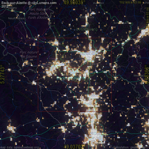
Esch-sur-Alzette night lights from space
Night Light of Esch-sur-Alzette from space (Luxembourg) Src. Average luminocity for 10x10km area is 57.5434% and for 50x50km: 25.331%.
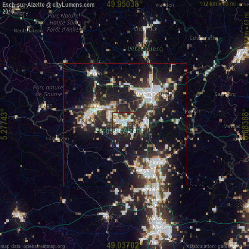
Analysis of Esch-sur-Alzette night lights 2016
Square area 10x10 km:
 13.45%
90-99
14.15%80-89
6.86%70-79
4.62%60-69
5.32%50-59
4.9%40-49
10.78%30-39
7.56%20-29
27.87%10-19
4.48%0-9
0%Square area 50x50 km:
4.79%90-99
4.91%80-89
2.46%70-79
2.16%60-69
2.12%50-59
2.75%40-49
2.94%30-39
4.21%20-29
10.54%10-19
18.75%0-9
44.36%Clear (daylight) street map image can be seen on geolist.org.
Map coordinates:
49° 57' 1.4" North, 5° 16' 38.7" East
49° 29' 45" North, 5° 58' 50" East
49° 2' 13.3" North, 6° 41' 1.2" East
Some cities around Esch-sur-Alzette sort by population:
• Dudelange
7.9 km =4.9 mi,  102°
102°
• Villerupt, FR
4.7 km =2.9 mi,  227°
227°
• Schifflange
2.6 km =1.6 mi,  63°
63°
• Bettembourg
9.2 km =5.7 mi,  73°
73°
• Pétange
10 km =6.2 mi,  313°
313°
• Audun-le-Tiche, FR
3.2 km =2 mi,  214°
214°
• Belvaux
4.4 km =2.7 mi,  291°
291°
• Differdange
7.2 km =4.5 mi,  296°
296°
2960596 (p: 28,228)
Sources (retrieved 2019-11-25):
» Earth at Night: Flat Maps 2012, 2016