Mont-Saint-Martin night lights from space
Night Light of Mont-Saint-Martin (Grand Est) from space (France) Src. Average luminocity for 10x10km area is 52.7297% and for 50x50km: 17.2794%.
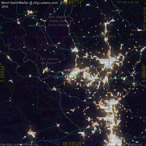
Analysis of Mont-Saint-Martin night lights 2016
Square area 10x10 km:
 10.64%
90-99
11.62%80-89
9.8%70-79
5.74%60-69
2.52%50-59
4.62%40-49
7.56%30-39
7.7%20-29
26.33%10-19
9.8%0-9
3.64%Square area 50x50 km:
3.07%90-99
3.14%80-89
1.81%70-79
1.58%60-69
1.46%50-59
1.84%40-49
2.05%30-39
2.93%20-29
7.62%10-19
13.47%0-9
61.03%Clear (daylight) street map image can be seen on geolist.org.
Map coordinates:
49° 59' 51.9" North, 5° 4' 48.9" East
49° 32' 37.1" North, 5° 47' 0.1" East
49° 5' 6.9" North, 6° 29' 11.4" East
Some cities around Mont-Saint-Martin sort by population:
• Aubange, BE
3 km =1.9 mi,  31°
31°
• Longwy
2.9 km =1.8 mi,  212°
212°
• Villerupt
13.7 km =8.5 mi,  128°
128°
• Pétange, LU
7.2 km =4.5 mi,  76°
76°
• Messancy, BE
6 km =3.7 mi, 25°
• Audun-le-Tiche
14.8 km =9.2 mi,  122°
122°
• Belvaux, LU
10.8 km =6.7 mi,  110°
110°
• Differdange, LU
8.1 km =5 mi, 105°
2991992 (p: 8,509)
Sources (retrieved 2019-11-25):
» Earth at Night: Flat Maps 2012, 2016