Monrovia night lights from space
Night Light of Monrovia (Montserrado) from space (Liberia) Src. Average luminocity for 10x10km area is 31.1688% and for 50x50km: 3.1352%.
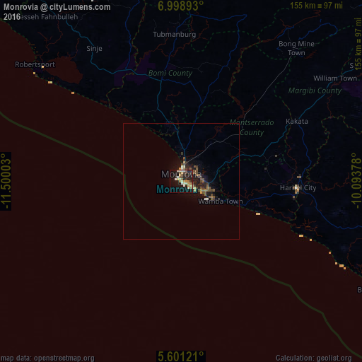
Analysis of Monrovia night lights 2016
Square area 10x10 km:
 2.16%
2.16%90-99
7.14%80-89
4.33%70-79
6.28%60-69
1.95%50-59
4.55%40-49
1.95%30-39
3.46%20-29
8.01%10-19
33.98%0-9
26.19%Square area 50x50 km:
0.16%90-99
0.37%80-89
0.23%70-79
0.48%60-69
0.24%50-59
0.82%40-49
0.58%30-39
0.45%20-29
0.73%10-19
3.39%0-9
92.55%Clear (daylight) street map image can be seen on geolist.org.
Map coordinates:
6° 59' 56.1" North, 11° 30' 0.1" West
6° 18' 1.9" North, 10° 47' 48.8" West
5° 36' 4.4" North, 10° 5' 37.6" West
Some cities around Monrovia sort by population:
• Kakata
55.3 km =34.4 mi,  62°
62°
• Bensonville
26.1 km =16.2 mi,  51°
51°
• Buchanan
95.1 km =59.1 mi,  119°
119°
• Robertsport
80.6 km =50.1 mi,  308°
308°
• Foindu, SL
148.3 km =92.1 mi,  326°
326°
• Bomi, SL
132.4 km =82.3 mi,  322°
322°
• Tubmanburg
63.4 km =39.4 mi,  357°
357°
• Bopolu
91.8 km =57 mi,  21°
21°
2274895 (p: 939,524)
Sources (retrieved 2019-11-25):
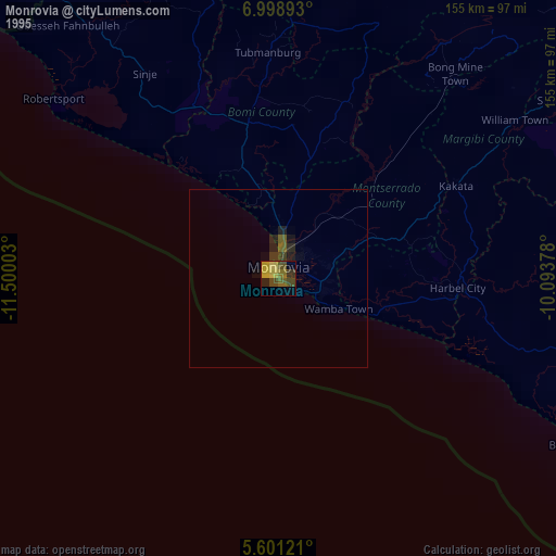
» NASA, Earths city lights 1995
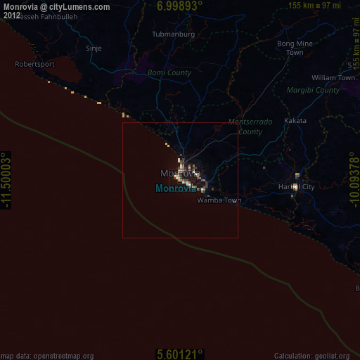
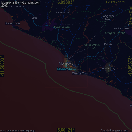
» NASA city lights 2003
» Earth at Night: Flat Maps 2012, 2016