Panadura night lights from space
Night Light of Panadura (Western) from space (Sri Lanka) Src. Average luminocity for 10x10km area is 31.4697% and for 50x50km: 16.0974%.
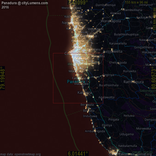
Analysis of Panadura night lights 2016
Square area 10x10 km:
 0.65%
0.65%90-99
2.81%80-89
6.06%70-79
4.98%60-69
3.25%50-59
8.01%40-49
5.63%30-39
9.09%20-29
10.61%10-19
28.14%0-9
20.78%Square area 50x50 km:
2.44%90-99
2.42%80-89
1.98%70-79
2.57%60-69
2.87%50-59
2.87%40-49
2.26%30-39
2.55%20-29
3.54%10-19
5.83%0-9
70.66%Clear (daylight) street map image can be seen on geolist.org.
Map coordinates:
7° 24' 39.6" North, 79° 11' 58.1" East
6° 42' 47.5" North, 79° 54' 9.4" East
6° 0' 51.9" North, 80° 36' 20.6" East
Some cities around Panadura sort by population:
• Dehiwala-Mount Lavinia
14.5 km =9 mi,  346°
346°
• Moratuwa
7 km =4.3 mi,  340°
340°
• Pita Kotte
19.7 km =12.2 mi,  359°
359°
• Sri Jayewardenepura Kotte
18.9 km =11.7 mi,  1°
1°
• Maharagama
15.2 km =9.4 mi,  9°
9°
• Kalutara
15.8 km =9.8 mi,  156°
156°
• Homagama
18.2 km =11.3 mi,  37°
37°
• Horana South
17.7 km =11 mi,  89°
89°
1231410 (p: 33,735)
Sources (retrieved 2019-11-25):
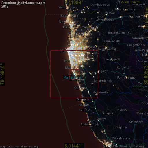
» Earth at Night: Flat Maps 2012, 2016