Pita Kotte night lights from space
Night Light of Pita Kotte (Western) from space (Sri Lanka) Src. Average luminocity for 10x10km area is 94.1364% and for 50x50km: 27.414%.
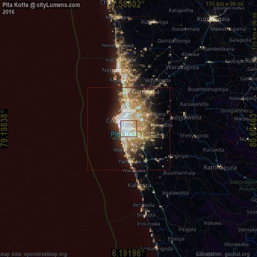

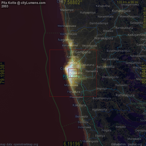
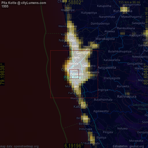
Analysis of Pita Kotte night lights 2016
Square area 10x10 km:
 40.04%
90-99
34.63%80-89
16.23%70-79
8.23%60-69
0.43%50-59
0%40-49
0.43%30-39
0%20-29
0%10-19
0%0-9
0%Square area 50x50 km:
4.22%90-99
4.76%80-89
3.57%70-79
4.38%60-69
5.05%50-59
4.7%40-49
4.15%30-39
3.83%20-29
5.7%10-19
8.88%0-9
50.76%Clear (daylight) street map image can be seen on geolist.org.
Map coordinates:
7° 35' 16.9" North, 79° 11' 54.2" East
6° 53' 25.8" North, 79° 54' 5.4" East
6° 11' 31.1" North, 80° 36' 16.7" East
Some cities around Pita Kotte sort by population:
• Dehiwala-Mount Lavinia
6.5 km =4 mi,  210°
210°
• Sri Jayewardenepura Kotte
1 km =0.6 mi,  143°
143°
• Battaramulla South
1.9 km =1.2 mi,  70°
70°
• Maharagama
5.5 km =3.4 mi,  149°
149°
• Kotikawatta
4.1 km =2.5 mi,  12°
12°
• Kolonnawa
5.1 km =3.2 mi,  338°
338°
• Mulleriyawa
5.7 km =3.5 mi,  33°
33°
• Kelaniya
7.6 km =4.7 mi,  17°
17°
1230089 (p: 118,179)
Sources (retrieved 2019-11-25):
» NASA, Earths city lights 1995
» NASA city lights 2003
» Earth at Night: Flat Maps 2012, 2016