Kolonnawa night lights from space
Night Light of Kolonnawa (Western) from space (Sri Lanka) Src. Average luminocity for 10x10km area is 94.0541% and for 50x50km: 28.5656%.
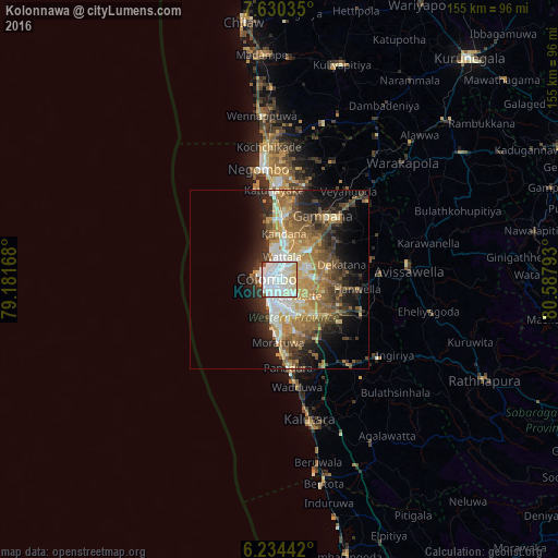
Analysis of Kolonnawa night lights 2016
Square area 10x10 km:
 45.89%
90-99
33.55%80-89
15.15%70-79
0.87%60-69
0%50-59
1.73%40-49
0.87%30-39
1.95%20-29
0%10-19
0%0-9
0%Square area 50x50 km:
4.29%90-99
4.86%80-89
3.62%70-79
4.54%60-69
5.42%50-59
4.92%40-49
4.49%30-39
3.99%20-29
6.41%10-19
9.76%0-9
47.69%Clear (daylight) street map image can be seen on geolist.org.
Map coordinates:
7° 37' 49.3" North, 79° 10' 54" East
6° 55' 58.4" North, 79° 53' 5.3" East
6° 14' 3.9" North, 80° 35' 16.5" East
Some cities around Kolonnawa sort by population:
• Colombo
4 km =2.5 mi,  274°
274°
• Pita Kotte
5.1 km =3.2 mi,  158°
158°
• Sri Jayewardenepura Kotte
6.1 km =3.8 mi, 156°
• Battaramulla South
5.5 km =3.4 mi,  137°
137°
• Kotikawatta
2.8 km =1.7 mi,  103°
103°
• Mulleriyawa
5 km =3.1 mi,  89°
89°
• Peliyagoda
4 km =2.5 mi,  358°
358°
• Kelaniya
4.8 km =3 mi,  58°
58°
1239593 (p: 58,076)
Sources (retrieved 2019-11-25):
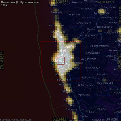
» NASA, Earths city lights 1995
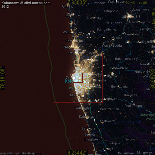
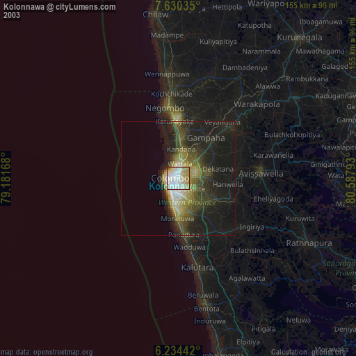
» NASA city lights 2003
» Earth at Night: Flat Maps 2012, 2016