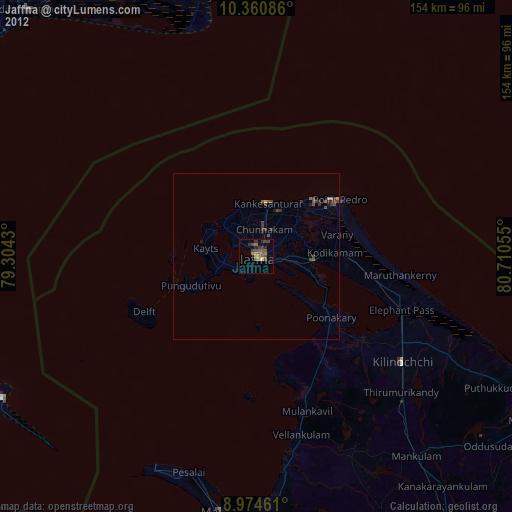
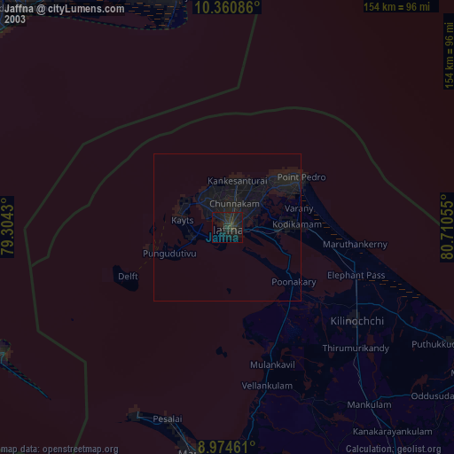
Jaffna night lights from space
Night Light of Jaffna (Northern Province) from space (Sri Lanka) Src. Average luminocity for 10x10km area is 31.881% and for 50x50km: 2.8087%.
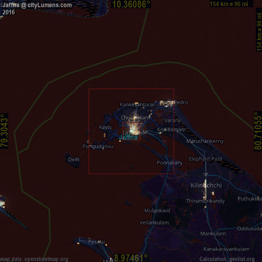

Analysis of Jaffna night lights 2016
Square area 10x10 km:
 1.08%
1.08%90-99
4.55%80-89
6.28%70-79
6.93%60-69
5.19%50-59
3.25%40-49
8.23%30-39
4.33%20-29
5.19%10-19
21.43%0-9
33.55%Square area 50x50 km:
0.05%90-99
0.27%80-89
0.32%70-79
0.38%60-69
0.28%50-59
0.33%40-49
0.83%30-39
1.06%20-29
0.78%10-19
2.11%0-9
93.6%Clear (daylight) street map image can be seen on geolist.org.
Map coordinates:
10° 21' 39.1" North, 79° 18' 15.5" East
9° 40' 6.4" North, 80° 0' 26.7" East
8° 58' 28.6" North, 80° 42' 38" East
Some cities around Jaffna sort by population:
• Point Pedro
29.7 km =18.5 mi,  56°
56°
• Valvedditturai
24 km =14.9 mi,  46°
46°
• Rameswaram, IN
87.1 km =54.1 mi,  240°
240°
• Vedaraniyam, IN
80.1 km =49.8 mi,  347°
347°
• Adirampattinam, IN
101.6 km =63.1 mi,  317°
317°
• Muttupet, IN
98.5 km =61.2 mi,  325°
325°
• Mandapam, IN
106.3 km =66.1 mi,  245°
245°
• Kilinochchi
52.5 km =32.6 mi,  125°
125°
1242833 (p: 169,102)
Sources (retrieved 2019-11-25):
» NASA, Earths city lights 1995
» NASA city lights 2003
» Earth at Night: Flat Maps 2012, 2016