Zahlé night lights from space
Night Light of Zahlé (Béqaa) from space (Lebanon) Src. Average luminocity for 10x10km area is 70.2273% and for 50x50km: 36.8404%.
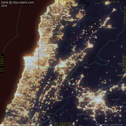
Analysis of Zahlé night lights 2016
Square area 10x10 km:
 10.66%
90-99
16.96%80-89
21.68%70-79
9.09%60-69
9.97%50-59
8.22%40-49
5.59%30-39
4.55%20-29
11.89%10-19
1.4%0-9
0%Square area 50x50 km:
2.96%90-99
4.76%80-89
11.67%70-79
4.81%60-69
4.34%50-59
4.37%40-49
6.55%30-39
6.09%20-29
9.45%10-19
17.51%0-9
27.49%Clear (daylight) street map image can be seen on geolist.org.
Map coordinates:
34° 25' 43.4" North, 35° 11' 56.1" East
33° 50' 48.3" North, 35° 54' 7.3" East
33° 15' 38.8" North, 36° 36' 18.6" East
Some cities around Zahlé sort by population:
• Beirut
37.3 km =23.2 mi,  277°
277°
• Ra’s Bayrūt
39.1 km =24.3 mi, 278°
• Jounieh
30.2 km =18.8 mi,  299°
299°
• Baalbek
34.1 km =21.2 mi,  58°
58°
• Az Zabadānī, SY
22.8 km =14.2 mi,  126°
126°
• Jbaïl
38.5 km =23.9 mi,  322°
322°
• Bcharré
46 km =28.6 mi,  12°
12°
• Baabda
33.1 km =20.6 mi,  267°
267°
266045 (p: 78,145)
Sources (retrieved 2019-11-25):
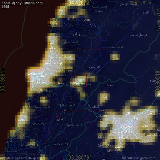
» NASA, Earths city lights 1995
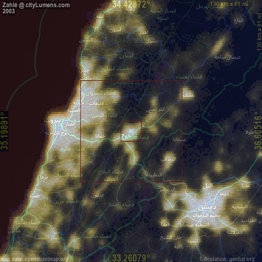
» NASA city lights 2003
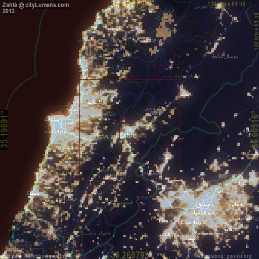
» Earth at Night: Flat Maps 2012, 2016