Baabda night lights from space
Night Light of Baabda (Mont-Liban) from space (Lebanon) Src. Average luminocity for 10x10km area is 96.5909% and for 50x50km: 41.6894%.
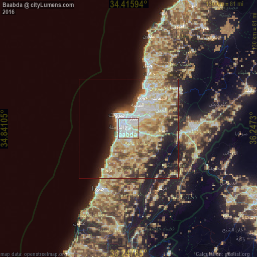
Analysis of Baabda night lights 2016
Square area 10x10 km:
 49.13%
90-99
34.44%80-89
15.21%70-79
1.22%60-69
0%50-59
0%40-49
0%30-39
0%20-29
0%10-19
0%0-9
0%Square area 50x50 km:
6.97%90-99
7.59%80-89
13.25%70-79
5.44%60-69
4.59%50-59
4.96%40-49
4.78%30-39
3.57%20-29
6.18%10-19
9.22%0-9
33.46%Clear (daylight) street map image can be seen on geolist.org.
Map coordinates:
34° 24' 57.4" North, 34° 50' 27.8" East
33° 50' 2" North, 35° 32' 39" East
33° 14' 52.3" North, 36° 14' 50.3" East
Some cities around Baabda sort by population:
• Beirut
7.7 km =4.8 mi,  329°
329°
• Ra’s Bayrūt
9.3 km =5.8 mi,  322°
322°
• Sidon
34.6 km =21.5 mi,  207°
207°
• Habboûch
47.8 km =29.7 mi,  186°
186°
• Jounieh
17.7 km =11 mi,  22°
22°
• Zahlé
33.1 km =20.6 mi,  87°
87°
• Ghazieh
38.7 km =24 mi,  204°
204°
• Jbaïl
33.3 km =20.7 mi, 16°
277226 (p: 9,000)
Sources (retrieved 2019-11-25):
» Earth at Night: Flat Maps 2012, 2016