Jbaïl night lights from space
Night Light of Jbaïl (Mont-Liban) from space (Lebanon) Src. Average luminocity for 10x10km area is 62.6575% and for 50x50km: 34.2436%.
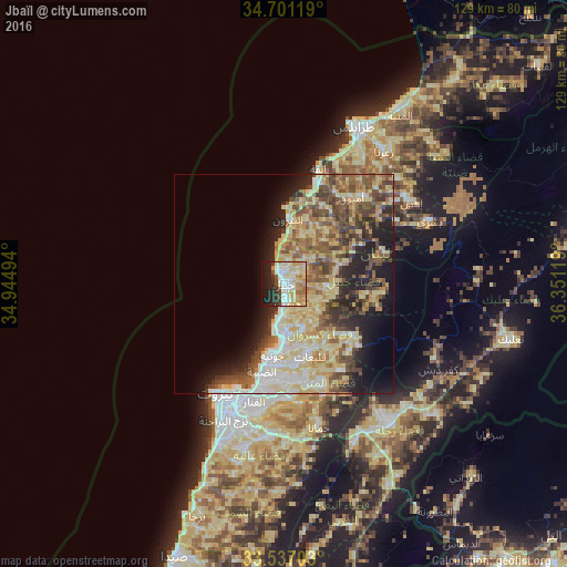
Analysis of Jbaïl night lights 2016
Square area 10x10 km:
 11.9%
11.9%90-99
16.12%80-89
15.93%70-79
11.54%60-69
5.49%50-59
0.92%40-49
4.95%30-39
5.31%20-29
13%10-19
14.84%0-9
0%Square area 50x50 km:
3.93%90-99
5.31%80-89
10.55%70-79
4.36%60-69
4.1%50-59
5.7%40-49
5.96%30-39
4.08%20-29
6.52%10-19
8.62%0-9
40.87%Clear (daylight) street map image can be seen on geolist.org.
Map coordinates:
34° 42' 4.3" North, 34° 56' 41.8" East
34° 7' 16" North, 35° 38' 53" East
33° 32' 13.3" North, 36° 21' 4.3" East
Some cities around Jbaïl sort by population:
• Beirut
28.7 km =17.8 mi,  208°
208°
• Ra’s Bayrūt
28.9 km =18 mi, 211°
• Tripoli
39.1 km =24.3 mi,  27°
27°
• Jounieh
15.8 km =9.8 mi,  190°
190°
• Zahlé
38.5 km =23.9 mi,  142°
142°
• Bcharré
36.3 km =22.6 mi,  66°
66°
• Batroûn
14.9 km =9.3 mi,  3°
3°
• Baabda
33.3 km =20.7 mi,  196°
196°
273203 (p: 20,784)
Sources (retrieved 2019-11-25):
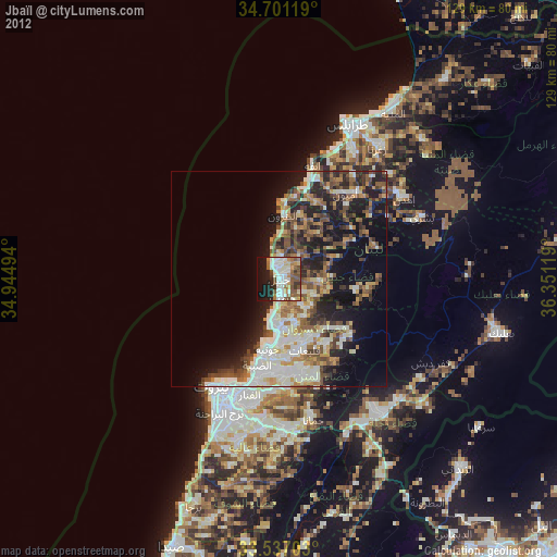
» Earth at Night: Flat Maps 2012, 2016