Atyrau night lights from space
Night Light of Atyrau (Atyraū) from space (Kazakhstan) Src. Average luminocity for 10x10km area is 64.2599% and for 50x50km: 4.6704%.
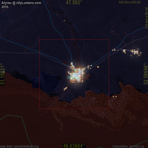
Analysis of Atyrau night lights 2016
Square area 10x10 km:
 15.48%
90-99
18.47%80-89
9.23%70-79
7.1%60-69
9.52%50-59
5.68%40-49
4.83%30-39
7.1%20-29
7.95%10-19
13.07%0-9
1.56%Square area 50x50 km:
0.73%90-99
0.98%80-89
0.57%70-79
0.46%60-69
0.7%50-59
0.51%40-49
0.42%30-39
0.7%20-29
1.29%10-19
2.99%0-9
90.65%Clear (daylight) street map image can be seen on geolist.org.
Map coordinates:
47° 35' 34.8" North, 51° 10' 48.8" East
47° 7' 0" North, 51° 52' 60" East
46° 38' 9.7" North, 52° 35' 11.3" East
Some cities around Atyrau sort by population:
• Qulsary
162.9 km =101.2 mi,  96°
96°
• Balykshi
5.7 km =3.5 mi,  192°
192°
• Maqat
123.1 km =76.5 mi,  61°
61°
• Inderbor
159.5 km =99.1 mi,  357°
357°
• Dossor
94.5 km =58.7 mi, 61°
• Qaraton
143.7 km =89.3 mi,  121°
121°
• Makhambet
65.2 km =40.5 mi,  339°
339°
• Maloye Ganyushkino
207.1 km =128.7 mi,  253°
253°
610529 (p: 180,000)
Sources (retrieved 2019-11-25):
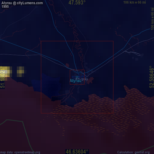
» NASA, Earths city lights 1995
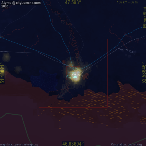
» NASA city lights 2003
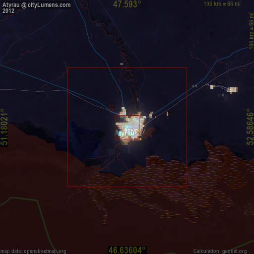
» Earth at Night: Flat Maps 2012, 2016