Balqash night lights from space
Night Light of Balqash (Karaganda) from space (Kazakhstan) Src. Average luminocity for 10x10km area is 25.994% and for 50x50km: 1.5543%.
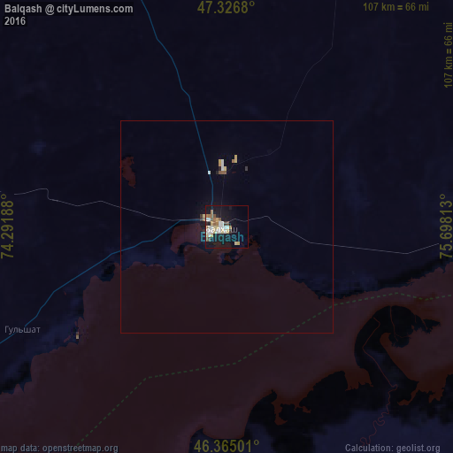

Analysis of Balqash night lights 2016
Square area 10x10 km:
 4.76%
4.76%90-99
5.21%80-89
4.46%70-79
2.23%60-69
3.72%50-59
2.68%40-49
2.38%30-39
0.74%20-29
2.08%10-19
27.83%0-9
43.9%Square area 50x50 km:
0.21%90-99
0.27%80-89
0.26%70-79
0.13%60-69
0.18%50-59
0.16%40-49
0.14%30-39
0.09%20-29
0.15%10-19
1.36%0-9
97.06%Clear (daylight) street map image can be seen on geolist.org.
Map coordinates:
47° 19' 36.5" North, 74° 17' 30.8" East
46° 50' 53" North, 74° 59' 42" East
46° 21' 54" North, 75° 41' 53.3" East
Some cities around Balqash sort by population:
• Ush-Tyube
290.8 km =180.7 mi,  127°
127°
• Priozersk
134.4 km =83.5 mi,  227°
227°
• Atasū
323.2 km =200.8 mi,  309°
309°
• Aktau
209.3 km =130.1 mi, 309°
• Aqadyr
224.4 km =139.4 mi, 314°
• Qarqaraly
287.4 km =178.6 mi,  7°
7°
• Bakanas
247.4 km =153.7 mi,  156°
156°
• Lepsy
309.7 km =192.4 mi,  102°
102°
1525798 (p: 81,364)
Sources (retrieved 2019-11-25):
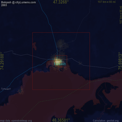
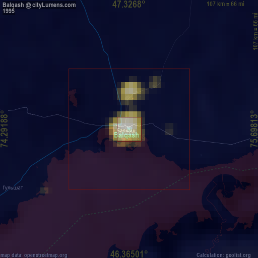
» NASA, Earths city lights 1995
» NASA city lights 2003
» Earth at Night: Flat Maps 2012, 2016