Ar Rābiyah night lights from space
Night Light of Ar Rābiyah (Al Asimah) from space (Kuwait) Src. Average luminocity for 10x10km area is 99.1818% and for 50x50km: 57.2218%.
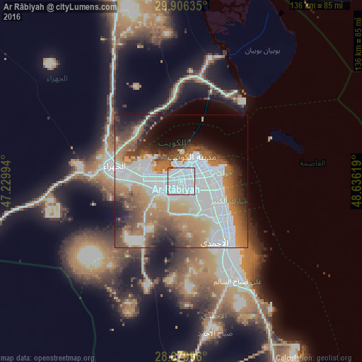
Analysis of Ar Rābiyah night lights 2016
Square area 10x10 km:
 87.5%
87.5%90-99
10.42%80-89
0%70-79
1.14%60-69
0.38%50-59
0.57%40-49
0%30-39
0%20-29
0%10-19
0%0-9
0%Square area 50x50 km:
22.97%90-99
8.89%80-89
3.35%70-79
6.1%60-69
11.23%50-59
6.72%40-49
6.35%30-39
5.41%20-29
5.29%10-19
6.88%0-9
16.81%Clear (daylight) street map image can be seen on geolist.org.
Map coordinates:
29° 54' 22.9" North, 47° 13' 47.8" East
29° 17' 42" North, 47° 55' 59" East
28° 40' 47.9" North, 48° 38' 10.3" East
Some cities around Ar Rābiyah sort by population:
• Ḩawallī
10.2 km =6.3 mi,  65°
65°
• Şabāḩ as Sālim
12.8 km =8 mi,  109°
109°
• Al Farwānīyah
3.2 km =2 mi,  128°
128°
• Kuwait City
9.4 km =5.8 mi,  27°
27°
• Bayān
11.3 km =7 mi,  85°
85°
• Janūb as Surrah
5.2 km =3.2 mi,  123°
123°
• Ad Dasmah
10.2 km =6.3 mi,  40°
40°
• Ash Shāmīyah
6.4 km =4 mi, 25°
388065 (p: 36,447)
Sources (retrieved 2019-11-25):
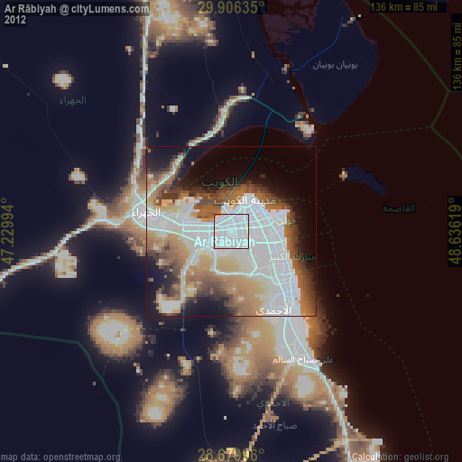
» Earth at Night: Flat Maps 2012, 2016