Al Farwānīyah night lights from space
Night Light of Al Farwānīyah (Al Farwaniyah) from space (Kuwait) Src. Average luminocity for 10x10km area is 99.6042% and for 50x50km: 57.3572%.
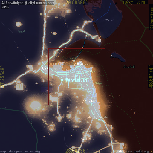
Analysis of Al Farwānīyah night lights 2016
Square area 10x10 km:
 88.83%
90-99
9.09%80-89
2.08%70-79
0%60-69
0%50-59
0%40-49
0%30-39
0%20-29
0%10-19
0%0-9
0%Square area 50x50 km:
23.08%90-99
8.92%80-89
3.24%70-79
6.06%60-69
11.27%50-59
6.84%40-49
6.72%30-39
5.46%20-29
4.98%10-19
6.13%0-9
17.31%Clear (daylight) street map image can be seen on geolist.org.
Map coordinates:
29° 53' 20.3" North, 47° 15' 19.8" East
29° 16' 39" North, 47° 57' 31" East
28° 39' 44.5" North, 48° 39' 42.3" East
Some cities around Al Farwānīyah sort by population:
• Ḩawallī
9.2 km =5.7 mi,  47°
47°
• Şabāḩ as Sālim
9.8 km =6.1 mi,  103°
103°
• Kuwait City
10.4 km =6.5 mi,  10°
10°
• Ar Rābiyah
3.2 km =2 mi,  308°
308°
• Bayān
9.2 km =5.7 mi,  71°
71°
• Janūb as Surrah
2.1 km =1.3 mi,  116°
116°
• Ad Dasmah
10.6 km =6.6 mi,  23°
23°
• Ash Shāmīyah
7.8 km =4.8 mi,  2°
2°
285815 (p: 86,525)
Sources (retrieved 2019-11-25):
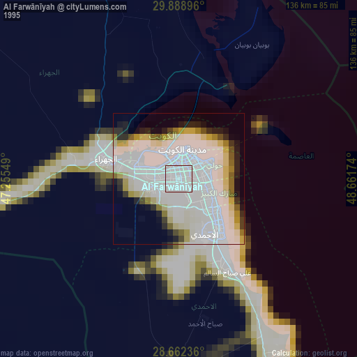
» NASA, Earths city lights 1995
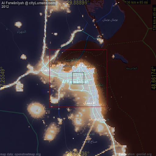
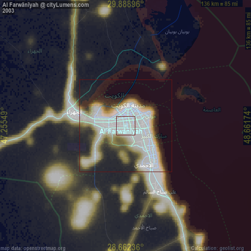
» NASA city lights 2003
» Earth at Night: Flat Maps 2012, 2016