Kant night lights from space
Night Light of Kant (Chüy) from space (Kyrgyzstan) Src. Average luminocity for 10x10km area is 14.1222% and for 50x50km: 8.9427%.
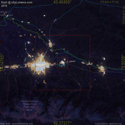
Analysis of Kant night lights 2016
Square area 10x10 km:
 0.48%
0.48%90-99
3.02%80-89
1.59%70-79
0.79%60-69
3.02%50-59
1.43%40-49
2.22%30-39
2.38%20-29
3.49%10-19
2.86%0-9
78.73%Square area 50x50 km:
1.63%90-99
2.1%80-89
0.9%70-79
0.8%60-69
1.48%50-59
0.87%40-49
1.04%30-39
1.14%20-29
2.08%10-19
3.26%0-9
84.71%Clear (daylight) street map image can be seen on geolist.org.
Map coordinates:
43° 24' 14.6" North, 74° 8' 51.5" East
42° 53' 27.8" North, 74° 51' 2.8" East
42° 22' 25.6" North, 75° 33' 14" East
Some cities around Kant sort by population:
• Bishkek
21.4 km =13.3 mi,  263°
263°
• Tokmok
37.1 km =23.1 mi,  98°
98°
• Kara-Balta
82.2 km =51.1 mi, 264°
• Chu, KZ
118.7 km =73.8 mi,  311°
311°
• Kaindy
96 km =59.7 mi,  265°
265°
• Kemin
69.5 km =43.2 mi, 99°
• Georgiyevka, KZ
19.9 km =12.4 mi,  325°
325°
• Sosnovka
82.9 km =51.5 mi,  250°
250°
1528193 (p: 20,181)
Sources (retrieved 2019-11-25):
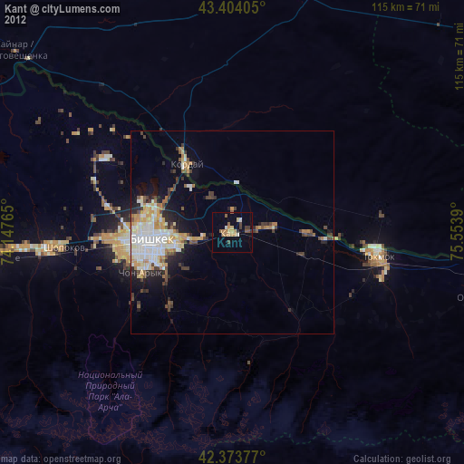
» Earth at Night: Flat Maps 2012, 2016