Bishkek night lights from space
Night Light of Bishkek from space (Kyrgyzstan) Src. Average luminocity for 10x10km area is 90.6619% and for 50x50km: 11.6493%.
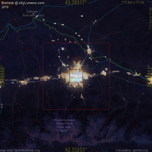
Analysis of Bishkek night lights 2016
Square area 10x10 km:
 35.24%
90-99
36.51%80-89
8.57%70-79
6.51%60-69
8.89%50-59
2.54%40-49
1.43%30-39
0.32%20-29
0%10-19
0%0-9
0%Square area 50x50 km:
1.82%90-99
2.36%80-89
1.2%70-79
1.17%60-69
2.13%50-59
1.47%40-49
1.28%30-39
1.58%20-29
2.99%10-19
5.19%0-9
78.81%Clear (daylight) street map image can be seen on geolist.org.
Map coordinates:
43° 22' 59.4" North, 73° 53' 12.8" East
42° 52' 12" North, 74° 35' 24" East
42° 21' 9.1" North, 75° 17' 35.3" East
Some cities around Bishkek sort by population:
• Tokmok
58.1 km =36.1 mi,  93°
93°
• Kara-Balta
60.8 km =37.8 mi,  264°
264°
• Chu, KZ
105.7 km =65.7 mi,  320°
320°
• Kant
21.4 km =13.3 mi,  83°
83°
• Kaindy
74.7 km =46.4 mi,  266°
266°
• Kemin
90.3 km =56.1 mi,  95°
95°
• Georgiyevka, KZ
21.3 km =13.2 mi,  28°
28°
• Sosnovka
62.3 km =38.7 mi,  245°
245°
1528675 (p: 900,000)
Sources (retrieved 2019-11-25):
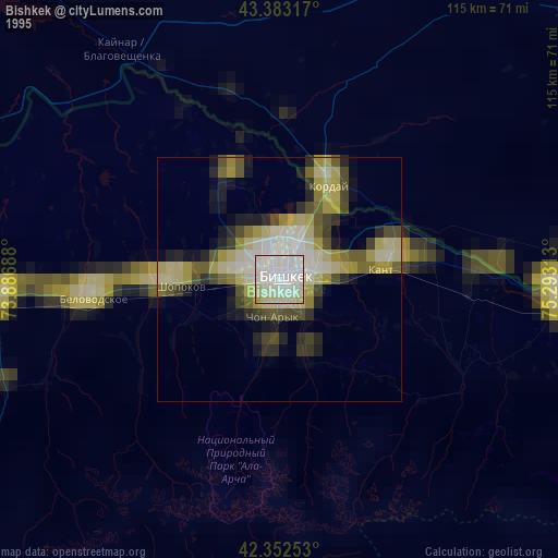
» NASA, Earths city lights 1995
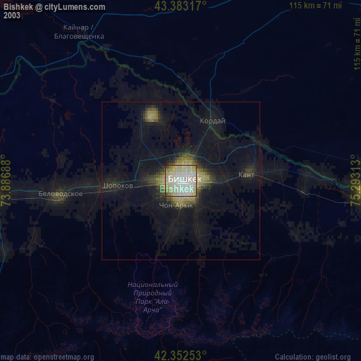
» NASA city lights 2003
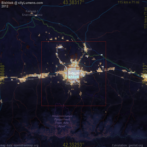
» Earth at Night: Flat Maps 2012, 2016