Kaindy night lights from space
Night Light of Kaindy (Chüy) from space (Kyrgyzstan) Src. Average luminocity for 10x10km area is 3.3894% and for 50x50km: 1.202%.
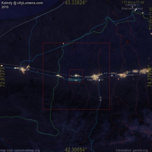
Analysis of Kaindy night lights 2016
Square area 10x10 km:
 0%
0%90-99
0%80-89
0.61%70-79
0%60-69
0.61%50-59
0.61%40-49
1.21%30-39
1.82%20-29
1.52%10-19
0.91%0-9
92.73%Square area 50x50 km:
0.03%90-99
0.05%80-89
0.15%70-79
0.08%60-69
0.26%50-59
0.27%40-49
0.28%30-39
0.32%20-29
0.45%10-19
0.48%0-9
97.64%Clear (daylight) street map image can be seen on geolist.org.
Map coordinates:
43° 20' 17.7" North, 72° 58' 21.8" East
42° 49' 28.9" North, 73° 40' 33.1" East
42° 18' 24.6" North, 74° 22' 44.3" East
Some cities around Kaindy sort by population:
• Bishkek
74.7 km =46.4 mi,  86°
86°
• Kara-Balta
14.1 km =8.8 mi, 94°
• Chu, KZ
86.8 km =53.9 mi,  4°
4°
• Merke, KZ
40.4 km =25.1 mi,  277°
277°
• Lugovoye, KZ
78.4 km =48.7 mi, 276°
• Lugovoy, KZ
75.7 km =47 mi, 279°
• Oytal, KZ
34.3 km =21.3 mi,  285°
285°
• Sosnovka
27.5 km =17.1 mi,  139°
139°
1528234 (p: 10,616)
Sources (retrieved 2019-11-25):
» Earth at Night: Flat Maps 2012, 2016