Batken night lights from space
Night Light of Batken from space (Kyrgyzstan) Src. Average luminocity for 10x10km area is 13.0779% and for 50x50km: 1.5648%.
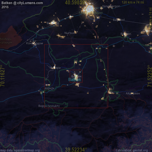
Analysis of Batken night lights 2016
Square area 10x10 km:
 0.97%
0.97%90-99
0.97%80-89
0.49%70-79
4.06%60-69
1.14%50-59
2.76%40-49
2.6%30-39
0.49%20-29
1.46%10-19
3.73%0-9
81.33%Square area 50x50 km:
0.06%90-99
0.1%80-89
0.12%70-79
0.27%60-69
0.35%50-59
0.31%40-49
0.21%30-39
0.55%20-29
0.31%10-19
0.33%0-9
97.4%Clear (daylight) street map image can be seen on geolist.org.
Map coordinates:
40° 35' 54.9" North, 70° 6' 58.6" East
40° 3' 45.3" North, 70° 49' 9.8" East
39° 31' 20.4" North, 71° 31' 21.1" East
Some cities around Batken sort by population:
• Qo‘qon, UZ
52.9 km =32.9 mi,  11°
11°
• Konibodom, TJ
41.8 km =26 mi,  307°
307°
• Isfara, TJ
18 km =11.2 mi,  293°
293°
• Oltiariq, UZ
66.6 km =41.4 mi,  56°
56°
• Beshariq, UZ
45.1 km =28 mi,  336°
336°
• Yaypan, UZ
34.8 km =21.6 mi,  359°
359°
• Hamza, UZ
71 km =44.1 mi, 55°
• Aydarken
46.4 km =28.8 mi,  106°
106°
1528735 (p: 10,155)
Sources (retrieved 2019-11-25):
» Earth at Night: Flat Maps 2012, 2016