Aydarken night lights from space
Night Light of Aydarken (Batken) from space (Kyrgyzstan) Src. Average luminocity for 10x10km area is 1.4082% and for 50x50km: 0.4889%.
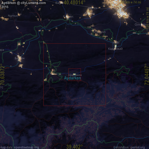
Analysis of Aydarken night lights 2016
Square area 10x10 km:
 0%
0%90-99
0%80-89
0%70-79
1.36%60-69
0%50-59
0%40-49
0.51%30-39
0.17%20-29
0%10-19
0%0-9
97.96%Square area 50x50 km:
0%90-99
0%80-89
0.05%70-79
0.09%60-69
0.07%50-59
0.12%40-49
0.09%30-39
0.16%20-29
0.29%10-19
0.1%0-9
99.02%Clear (daylight) street map image can be seen on geolist.org.
Map coordinates:
40° 28' 48.5" North, 70° 38' 19.4" East
39° 56' 35.5" North, 71° 20' 30.6" East
39° 24' 7.2" North, 72° 2' 41.9" East
Some cities around Aydarken sort by population:
• Fergana, UZ
61.8 km =38.4 mi,  37°
37°
• Isfara, TJ
64.3 km =40 mi,  288°
288°
• Oltiariq, UZ
51.1 km =31.8 mi,  12°
12°
• Kirguli, UZ
65.6 km =40.8 mi,  33°
33°
• Yangi Marg‘ilon, UZ
62.6 km =38.9 mi, 30°
• Hamza, UZ
55.6 km =34.5 mi, 14°
• Batken
46.4 km =28.8 mi, 286°
• Shohimardon, UZ
39.7 km =24.7 mi,  83°
83°
1222635 (p: 11,857)
Sources (retrieved 2019-11-25):
» Earth at Night: Flat Maps 2012, 2016