Qo‘qon night lights from space
Night Light of Qo‘qon (Fergana) from space (Uzbekistan) Src. Average luminocity for 10x10km area is 63.3537% and for 50x50km: 5.928%.
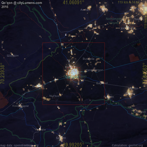
Analysis of Qo‘qon night lights 2016
Square area 10x10 km:
 10.37%
90-99
18.88%80-89
8.33%70-79
10.2%60-69
9.69%50-59
5.78%40-49
6.8%30-39
8.5%20-29
14.46%10-19
6.97%0-9
0%Square area 50x50 km:
0.48%90-99
0.9%80-89
0.48%70-79
0.55%60-69
0.71%50-59
0.75%40-49
1.16%30-39
1.61%20-29
2.68%10-19
3.59%0-9
87.09%Clear (daylight) street map image can be seen on geolist.org.
Map coordinates:
41° 3' 39.3" North, 70° 14' 21.8" East
40° 31' 43" North, 70° 56' 33" East
39° 59' 31.4" North, 71° 38' 44.3" East
Some cities around Qo‘qon sort by population:
• Konibodom, TJ
50.5 km =31.4 mi,  238°
238°
• Isfara, TJ
52.2 km =32.4 mi,  211°
211°
• Oltiariq
47.5 km =29.5 mi,  108°
108°
• Pop
40.8 km =25.4 mi,  20°
20°
• Beshariq
29.9 km =18.6 mi,  249°
249°
• Yaypan
20.1 km =12.5 mi, 212°
• Hamza
48.9 km =30.4 mi,  103°
103°
• Shaydon, TJ
52.4 km =32.6 mi,  287°
287°
1512979 (p: 187,477)
Sources (retrieved 2019-11-25):
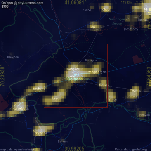
» NASA, Earths city lights 1995
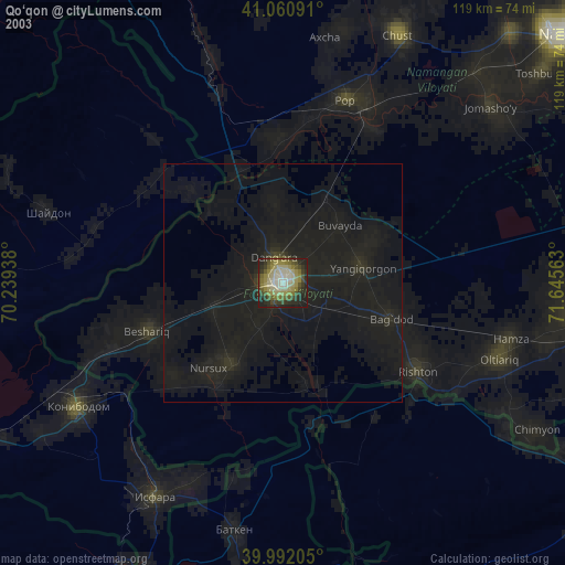
» NASA city lights 2003
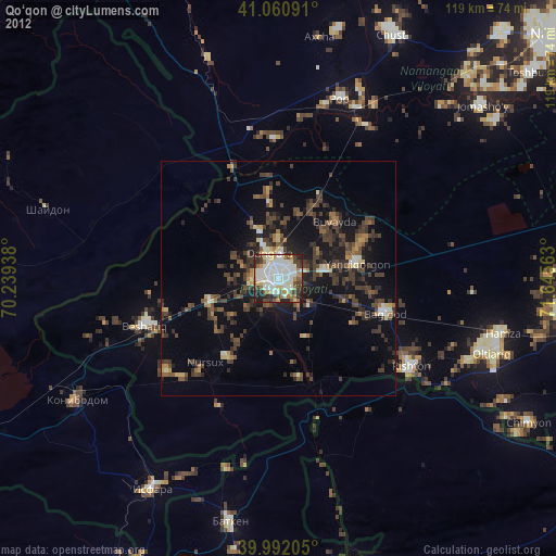
» Earth at Night: Flat Maps 2012, 2016