Hamza night lights from space
Night Light of Hamza (Fergana) from space (Uzbekistan) Src. Average luminocity for 10x10km area is 15.2823% and for 50x50km: 9.0138%.
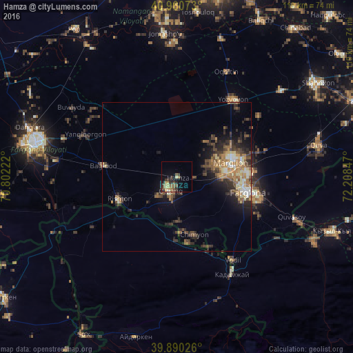
Analysis of Hamza night lights 2016
Square area 10x10 km:
 0.34%
0.34%90-99
0.17%80-89
4.08%70-79
1.19%60-69
2.55%50-59
5.78%40-49
0.51%30-39
4.59%20-29
3.91%10-19
7.82%0-9
69.05%Square area 50x50 km:
0.4%90-99
1.21%80-89
1.28%70-79
1.24%60-69
1.68%50-59
1.59%40-49
1.63%30-39
2.06%20-29
2.99%10-19
4.11%0-9
81.79%Clear (daylight) street map image can be seen on geolist.org.
Map coordinates:
40° 57' 38.6" North, 70° 48' 8" East
40° 25' 39.4" North, 71° 30' 19.2" East
39° 53' 24.9" North, 72° 12' 30.5" East
Some cities around Hamza sort by population:
• Qo‘qon
48.9 km =30.4 mi,  283°
283°
• Fergana
24.1 km =15 mi,  101°
101°
• Marg‘ilon
19.2 km =11.9 mi,  74°
74°
• Quvasoy
42.8 km =26.6 mi,  109°
109°
• Toshloq
22.9 km =14.2 mi,  76°
76°
• Oltiariq
4.8 km =3 mi,  213°
213°
• Kirguli
22.2 km =13.8 mi,  87°
87°
• Yangi Marg‘ilon
18.1 km =11.2 mi, 90°
1513650 (p: 13,470)
Sources (retrieved 2019-11-25):
» Earth at Night: Flat Maps 2012, 2016