Nyahururu night lights from space
Night Light of Nyahururu (Laikipia) from space (Kenya) Src. Average luminocity for 10x10km area is 11.8463% and for 50x50km: 0.7747%.

Analysis of Nyahururu night lights 2016
Square area 10x10 km:
 0.22%
0.22%90-99
0.65%80-89
2.38%70-79
3.68%60-69
1.73%50-59
0.87%40-49
4.33%30-39
0.87%20-29
0.87%10-19
0%0-9
84.42%Square area 50x50 km:
0.01%90-99
0.03%80-89
0.1%70-79
0.17%60-69
0.1%50-59
0.09%40-49
0.36%30-39
0.21%20-29
0.07%10-19
0.03%0-9
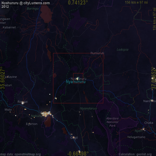
98.82%Clear (daylight) street map image can be seen on geolist.org.
Map coordinates:
0° 44' 28.4" North, 35° 39' 37" East
0° 2' 17.3" North, 36° 21' 48.2" East
0° 39' 53.9" South, 37° 3' 59.5" East
Some cities around Nyahururu sort by population:
• Nakuru
50.2 km =31.2 mi,  220°
220°
• Ol Kalou
34.4 km =21.4 mi,  177°
177°
• Rongai
60.4 km =37.5 mi,  247°
247°
• Molo
77.1 km =47.9 mi, 245°
• Eldama Ravine
70.7 km =43.9 mi,  271°
271°
• Naro Moru
76.1 km =47.3 mi,  107°
107°
• Baringo
64.9 km =40.3 mi,  317°
317°
• Rumuruti
32.5 km =20.2 mi,  36°
36°
183027 (p: 31,978)
Sources (retrieved 2019-11-25):
» Earth at Night: Flat Maps 2012, 2016