Garissa night lights from space
Night Light of Garissa from space (Kenya) Src. Average luminocity for 10x10km area is 26.961% and for 50x50km: 1.2621%.
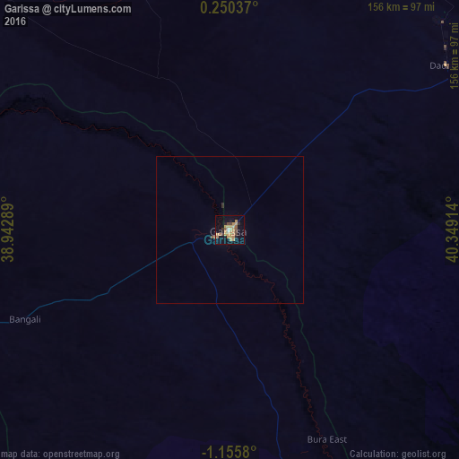

Analysis of Garissa night lights 2016
Square area 10x10 km:
 0.65%
0.65%90-99
1.08%80-89
4.11%70-79
11.04%60-69
6.06%50-59
2.6%40-49
2.6%30-39
2.38%20-29
2.81%10-19
20.78%0-9
45.89%Square area 50x50 km:
0.03%90-99
0.04%80-89
0.16%70-79
0.46%60-69
0.24%50-59
0.13%40-49
0.11%30-39
0.1%20-29
0.17%10-19
0.85%0-9
97.7%Clear (daylight) street map image can be seen on geolist.org.
Map coordinates:
0° 15' 1.3" North, 38° 56' 34.4" East
0° 27' 9.9" South, 39° 38' 45.6" East
1° 9' 20.9" South, 40° 20' 56.9" East
Some cities around Garissa sort by population:
• Meru
228.1 km =141.7 mi,  284°
284°
• Kitui
208.3 km =129.4 mi,  240°
240°
• Mwingi
184.4 km =114.6 mi,  253°
253°
• Maua
204.4 km =127 mi,  291°
291°
• Chuka
222.8 km =138.4 mi,  273°
273°
• Hola
122.3 km =76 mi,  159°
159°
• Witu
232.6 km =144.5 mi, 157°
• Kathwana
198.1 km =123.1 mi, 273°
197745 (p: 67,861)
Sources (retrieved 2019-11-25):
» NASA, Earths city lights 1995
» NASA city lights 2003
» Earth at Night: Flat Maps 2012, 2016