Yonago night lights from space
Night Light of Yonago (Tottori) from space (Japan) Src. Average luminocity for 10x10km area is 36.4066% and for 50x50km: 4.4621%.
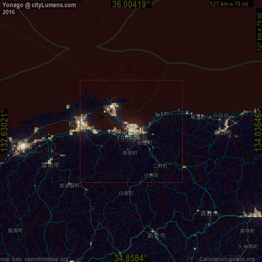
Analysis of Yonago night lights 2016
Square area 10x10 km:
 0.92%
0.92%90-99
3.66%80-89
10.44%70-79
7.14%60-69
3.48%50-59
5.68%40-49
6.41%30-39
3.3%20-29
9.71%10-19
37.73%0-9
11.54%Square area 50x50 km:
0.12%90-99
0.26%80-89
0.86%70-79
0.57%60-69
0.66%50-59
0.64%40-49
0.87%30-39
0.73%20-29
1.27%10-19
3.92%0-9
90.09%Clear (daylight) street map image can be seen on geolist.org.
Map coordinates:
36° 0' 15.1" North, 132° 37' 48.8" East
35° 25' 60" North, 133° 19' 60" East
34° 51' 30.2" North, 134° 2' 11.3" East
Some cities around Yonago sort by population:
• Matsue
26.3 km =16.3 mi,  282°
282°
• Izumo
51.9 km =32.2 mi,  261°
261°
• Kurayoshi
43.8 km =27.2 mi,  90°
90°
• Sakaiminato
14.9 km =9.3 mi,  321°
321°
• Yasugichō
8.4 km =5.2 mi, 260°
• Hiratachō
46.8 km =29.1 mi,  270°
270°
• Niimi
51.5 km =32 mi,  166°
166°
• Shōbara
71 km =44.1 mi,  203°
203°
1848277 (p: 141,368)
Sources (retrieved 2019-11-25):
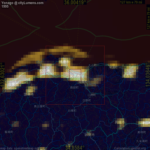
» NASA, Earths city lights 1995
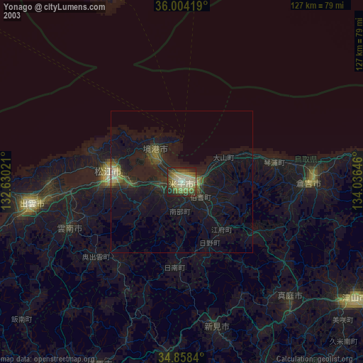
» NASA city lights 2003
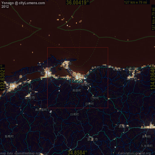
» Earth at Night: Flat Maps 2012, 2016