Izumo night lights from space
Night Light of Izumo (Shimane) from space (Japan) Src. Average luminocity for 10x10km area is 28.1923% and for 50x50km: 2.7067%.
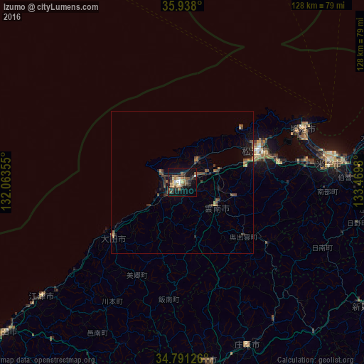
Analysis of Izumo night lights 2016
Square area 10x10 km:
 2.56%
2.56%90-99
2.56%80-89
2.75%70-79
3.85%60-69
4.58%50-59
6.04%40-49
5.31%30-39
6.59%20-29
6.78%10-19
28.57%0-9
30.4%Square area 50x50 km:
0.1%90-99
0.1%80-89
0.21%70-79
0.28%60-69
0.55%50-59
0.64%40-49
0.63%30-39
0.58%20-29
0.8%10-19
2.11%0-9
94%Clear (daylight) street map image can be seen on geolist.org.
Map coordinates:
35° 56' 16.8" North, 132° 3' 48.8" East
35° 22' 0" North, 132° 46' 0" East
34° 47' 28.5" North, 133° 28' 11.3" East
Some cities around Izumo sort by population:
• Matsue
28.8 km =17.9 mi,  63°
63°
• Yonago
51.9 km =32.2 mi,  81°
81°
• Sakaiminato
46.2 km =28.7 mi,  65°
65°
• Ōdachō-ōda
30.6 km =19 mi,  230°
230°
• Yasugichō
43.5 km =27 mi, 81°
• Hiratachō
8.7 km =5.4 mi,  31°
31°
• Gōtsuchō
63.3 km =39.3 mi, 230°
• Shōbara
61.8 km =38.4 mi,  158°
158°
1861084 (p: 89,286)
Sources (retrieved 2019-11-25):
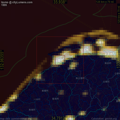
» NASA, Earths city lights 1995
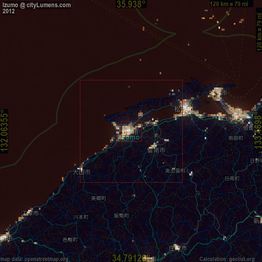
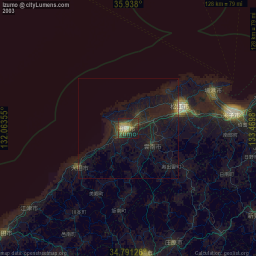
» NASA city lights 2003
» Earth at Night: Flat Maps 2012, 2016