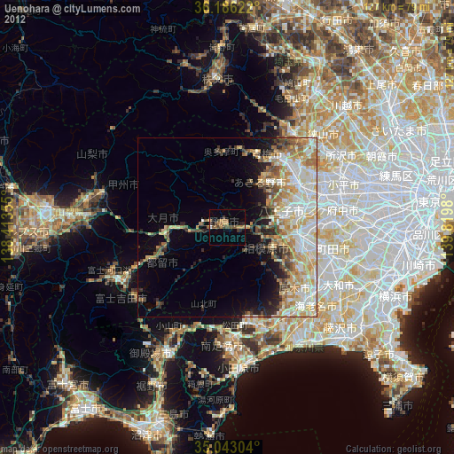
Uenohara night lights from space
Night Light of Uenohara (Yamanashi) from space (Japan) Src. Average luminocity for 10x10km area is 10.7692% and for 50x50km: 21.3294%.
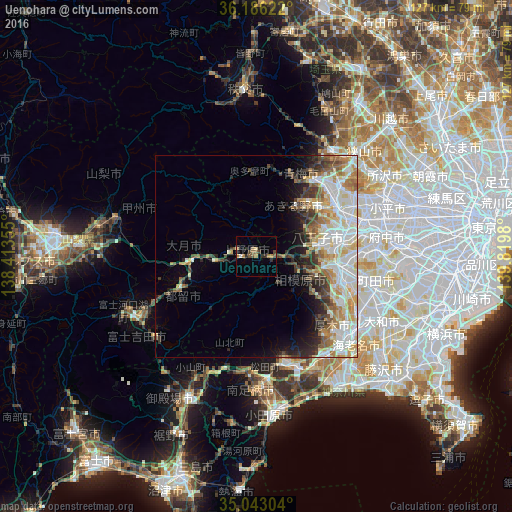
Analysis of Uenohara night lights 2016
Square area 10x10 km:
100  0.52%
0.52%
90-99 0.17%
80-89 0.7%
70-79 2.27%
60-69 2.62%
50-59 2.27%
40-49 2.27%
30-39 1.57%
20-29 3.67%
10-19 0%
0-9 83.92%
0.52%90-99
0.17%80-89
0.7%70-79
2.27%60-69
2.62%50-59
2.27%40-49
2.27%30-39
1.57%20-29
3.67%10-19
0%0-9
83.92%Square area 50x50 km:
100 4.57%
90-99 5.53%
80-89 2.85%
70-79 2.54%
60-69 2.81%
50-59 2.2%
40-49 2.46%
30-39 2.42%
20-29 3.16%
10-19 4.2%
0-9 67.25%
4.57%90-99
5.53%80-89
2.85%70-79
2.54%60-69
2.81%50-59
2.2%40-49
2.46%30-39
2.42%20-29
3.16%10-19
4.2%0-9
67.25%Clear (daylight) street map image can be seen on geolist.org.
Map coordinates:
36° 11' 10.4" North, 138° 24' 48.8" East
35° 37' 0" North, 139° 7' 0" East
35° 2' 34.9" North, 139° 49' 11.3" East
Some cities around Uenohara sort by population:
• Hachiōji
19.2 km =11.9 mi,  76°
76°
• Hadano
29 km =18 mi,  160°
160°
• Hino
26.4 km =16.4 mi, 76°
• Ōme
21.8 km =13.5 mi,  31°
31°
• Zama
28.7 km =17.8 mi,  119°
119°
• Fussa
23 km =14.3 mi,  54°
54°
• Ōtsuki
12.9 km =8 mi,  270°
270°
• Itsukaichi
15.1 km =9.4 mi,  37°
37°
1849407 (p: 27,840)
Sources (retrieved 2019-11-25):
» Earth at Night: Flat Maps 2012, 2016