Hadano night lights from space
Night Light of Hadano (Kanagawa) from space (Japan) Src. Average luminocity for 10x10km area is 49.9597% and for 50x50km: 30.5112%.
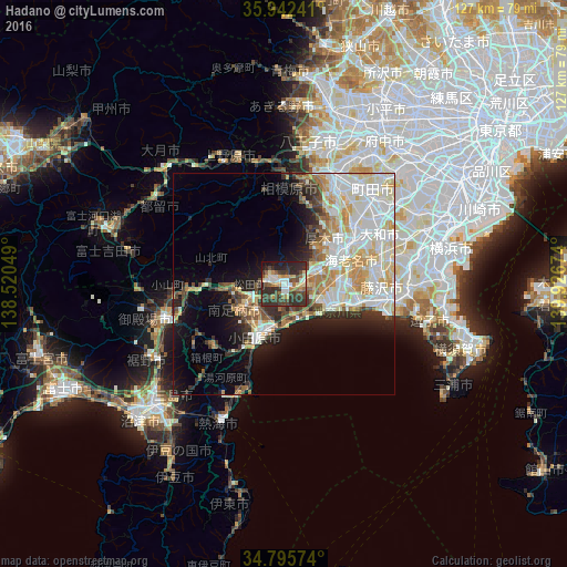
Analysis of Hadano night lights 2016
Square area 10x10 km:
 7.33%
7.33%90-99
7.51%80-89
6.04%70-79
5.68%60-69
6.59%50-59
5.49%40-49
13.37%30-39
16.12%20-29
24.73%10-19
7.14%0-9
0%Square area 50x50 km:
7.33%90-99
8.06%80-89
4.17%70-79
3.87%60-69
3.14%50-59
2.15%40-49
2.99%30-39
3.08%20-29
5.1%10-19
8.45%0-9
51.66%Clear (daylight) street map image can be seen on geolist.org.
Map coordinates:
35° 56' 32.7" North, 138° 31' 13.8" East
35° 22' 16" North, 139° 13' 25" East
34° 47' 44.7" North, 139° 55' 36.3" East
Some cities around Hadano sort by population:
• Hiratsuka
11.4 km =7.1 mi,  115°
115°
• Chigasaki
16.8 km =10.4 mi,  103°
103°
• Atsugi
15.4 km =9.6 mi,  58°
58°
• Odawara
14.1 km =8.8 mi,  204°
204°
• Zama
20 km =12.4 mi,  49°
49°
• Isehara
8.5 km =5.3 mi,  68°
68°
• Ōiso
10.4 km =6.5 mi,  126°
126°
• Ninomiya
8.3 km =5.2 mi,  159°
159°
1863431 (p: 174,281)
Sources (retrieved 2019-11-25):
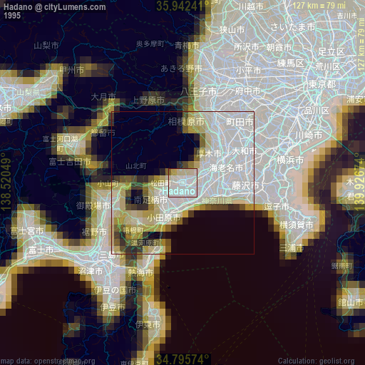
» NASA, Earths city lights 1995
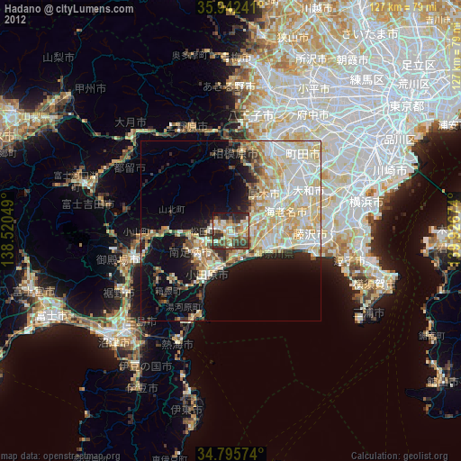
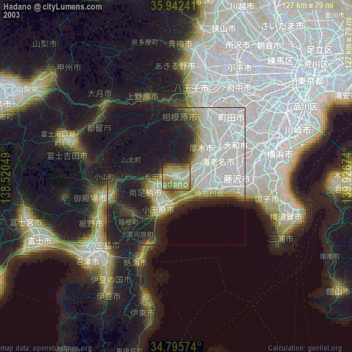
» NASA city lights 2003
» Earth at Night: Flat Maps 2012, 2016