Tomioka night lights from space
Night Light of Tomioka (Gunma) from space (Japan) Src. Average luminocity for 10x10km area is 24.4178% and for 50x50km: 17.3866%.
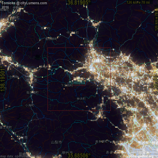
Analysis of Tomioka night lights 2016
Square area 10x10 km:
 0.17%
0.17%90-99
2.62%80-89
2.62%70-79
3.32%60-69
1.92%50-59
5.59%40-49
5.24%30-39
3.85%20-29
5.42%10-19
41.78%0-9
27.45%Square area 50x50 km:
1.06%90-99
2.98%80-89
2.22%70-79
2.54%60-69
3.78%50-59
3.68%40-49
3.28%30-39
2.88%20-29
4.01%10-19
7.73%0-9
65.85%Clear (daylight) street map image can be seen on geolist.org.
Map coordinates:
36° 49' 8.6" North, 138° 11' 42" East
36° 15' 14.8" North, 138° 53' 53.3" East
35° 41' 6.2" North, 139° 36' 4.5" East
Some cities around Tomioka sort by population:
• Maebashi
23.2 km =14.4 mi,  45°
45°
• Takasaki
13.8 km =8.6 mi, 50°
• Fujioka
15.6 km =9.7 mi,  93°
93°
• Annaka
8.5 km =5.3 mi,  358°
358°
• Tamamura
20.2 km =12.6 mi,  75°
75°
• Kanekomachi
19.5 km =12.1 mi,  26°
26°
• Yoshii
7.7 km =4.8 mi, 93°
• Kodamachō-kodamaminami
22.3 km =13.9 mi,  110°
110°
1850091 (p: 49,281)
Sources (retrieved 2019-11-25):
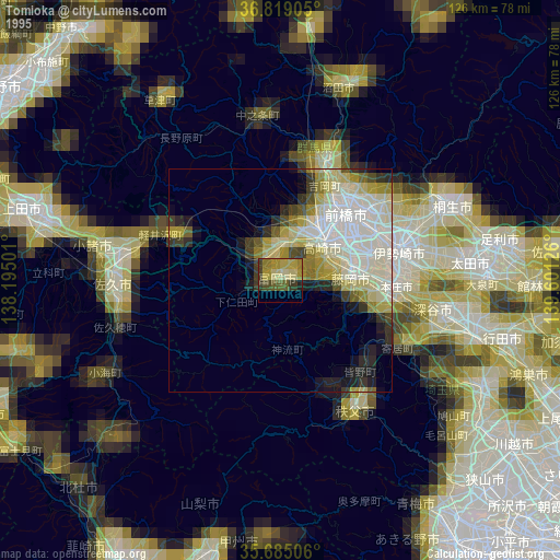
» NASA, Earths city lights 1995
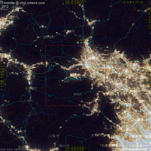
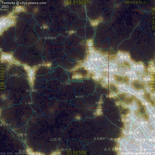
» NASA city lights 2003
» Earth at Night: Flat Maps 2012, 2016