Takasaki night lights from space
Night Light of Takasaki (Gunma) from space (Japan) Src. Average luminocity for 10x10km area is 71.0385% and for 50x50km: 25.8344%.
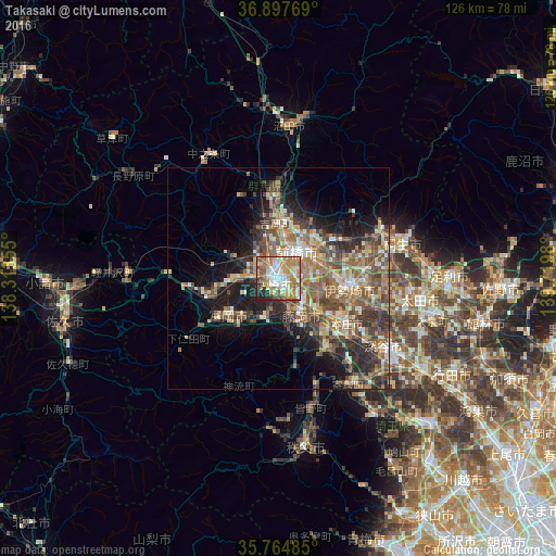
Analysis of Takasaki night lights 2016
Square area 10x10 km:
 9.09%
9.09%90-99
22.2%80-89
8.57%70-79
14.86%60-69
19.41%50-59
8.22%40-49
4.55%30-39
4.55%20-29
8.22%10-19
0.35%0-9
0%Square area 50x50 km:
1.59%90-99
4.3%80-89
3.34%70-79
3.63%60-69
5.43%50-59
6.34%40-49
5.22%30-39
5.17%20-29
6.03%10-19
9.55%0-9
49.41%Clear (daylight) street map image can be seen on geolist.org.
Map coordinates:
36° 53' 51.7" North, 138° 18' 48.8" East
36° 19' 60" North, 139° 1' 0" East
35° 45' 53.5" North, 139° 43' 11.3" East
Some cities around Takasaki sort by population:
• Maebashi
9.5 km =5.9 mi,  38°
38°
• Isesaki
16.5 km =10.3 mi,  96°
96°
• Fujioka
10.9 km =6.8 mi,  152°
152°
• Tomioka
13.8 km =8.6 mi,  230°
230°
• Annaka
10.8 km =6.7 mi,  268°
268°
• Tamamura
9.7 km =6 mi,  112°
112°
• Kanekomachi
8.8 km =5.5 mi,  348°
348°
• Yoshii
9.7 km =6 mi,  197°
197°
1851002 (p: 240,857)
Sources (retrieved 2019-11-25):
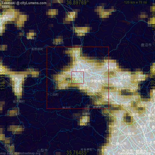
» NASA, Earths city lights 1995
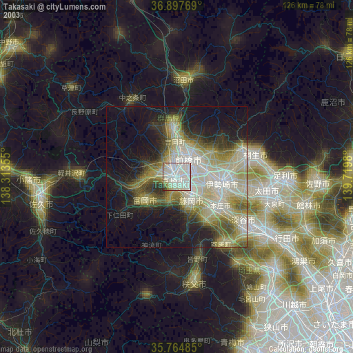
» NASA city lights 2003
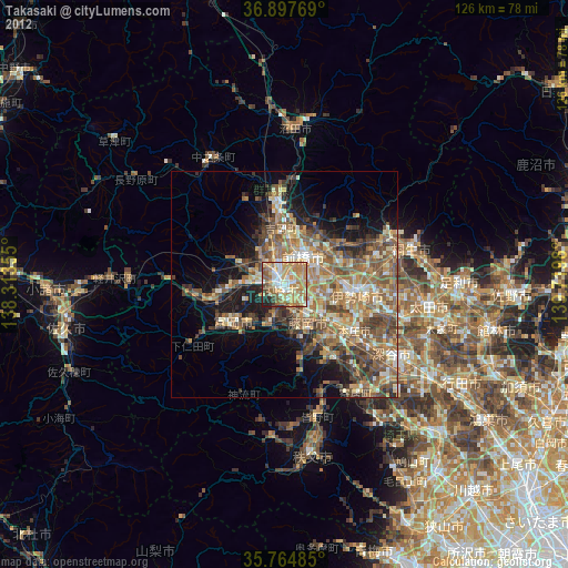
» Earth at Night: Flat Maps 2012, 2016