Maebashi night lights from space
Night Light of Maebashi (Gunma) from space (Japan) Src. Average luminocity for 10x10km area is 72.1818% and for 50x50km: 28.4302%.
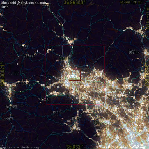

Analysis of Maebashi night lights 2016
Square area 10x10 km:
 11.19%
90-99
16.43%80-89
10.84%70-79
16.08%60-69
21.15%50-59
10.49%40-49
3.32%30-39
6.29%20-29
2.97%10-19
1.22%0-9
0%Square area 50x50 km:
1.89%90-99
5.03%80-89
3.82%70-79
3.97%60-69
5.82%50-59
6.9%40-49
6.32%30-39
5.64%20-29
5.38%10-19
8.94%0-9
46.29%Clear (daylight) street map image can be seen on geolist.org.
Map coordinates:
36° 57' 50" North, 138° 22' 48.8" East
36° 24' 0" North, 139° 4' 60" East
35° 49' 55.2" North, 139° 47' 11.3" East
Some cities around Maebashi sort by population:
• Takasaki
9.5 km =5.9 mi,  218°
218°
• Isesaki
14 km =8.7 mi,  131°
131°
• Fujioka
17.1 km =10.6 mi,  183°
183°
• Shibukawa
11.9 km =7.4 mi,  321°
321°
• Annaka
18.5 km =11.5 mi,  245°
245°
• Tamamura
11.5 km =7.1 mi,  164°
164°
• Kanekomachi
7.9 km =4.9 mi,  278°
278°
• Ōmamachō-ōmama
17.5 km =10.9 mi,  78°
78°
1857843 (p: 282,711)
Sources (retrieved 2019-11-25):
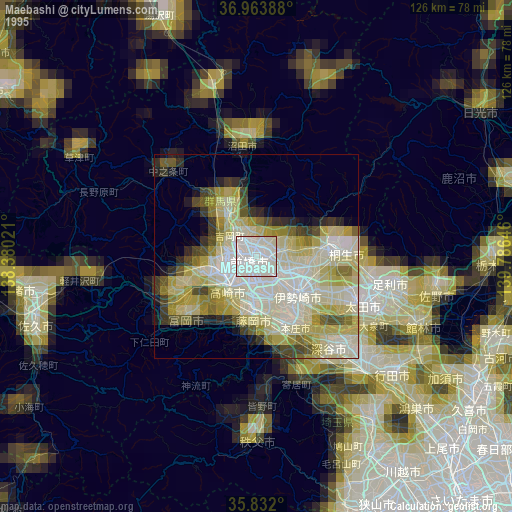
» NASA, Earths city lights 1995
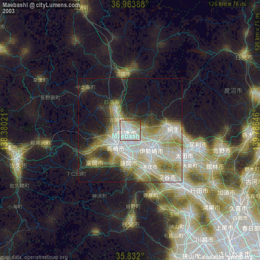
» NASA city lights 2003
» Earth at Night: Flat Maps 2012, 2016