Kodamachō-kodamaminami night lights from space
Night Light of Kodamachō-kodamaminami (Saitama) from space (Japan) Src. Average luminocity for 10x10km area is 31.3566% and for 50x50km: 35.5663%.
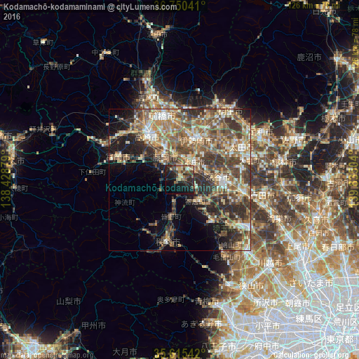
Analysis of Kodamachō-kodamaminami night lights 2016
Square area 10x10 km:
 1.22%
1.22%90-99
3.15%80-89
4.2%70-79
4.2%60-69
6.47%50-59
3.15%40-49
9.09%30-39
5.94%20-29
14.51%10-19
29.72%0-9
18.36%Square area 50x50 km:
2.51%90-99
6.26%80-89
4.62%70-79
5.22%60-69
7.15%50-59
8.03%40-49
8.45%30-39
7.81%20-29
8.06%10-19
8.78%0-9
33.11%Clear (daylight) street map image can be seen on geolist.org.
Map coordinates:
36° 45' 1.5" North, 138° 25' 43.6" East
36° 11' 5.9" North, 139° 7' 54.9" East
35° 36' 55.5" North, 139° 50' 6.1" East
Some cities around Kodamachō-kodamaminami sort by population:
• Isesaki
15.9 km =9.9 mi,  22°
22°
• Fukayachō
13.7 km =8.5 mi,  82°
82°
• Fujioka
8.7 km =5.4 mi,  321°
321°
• Honjō
7.9 km =4.9 mi,  41°
41°
• Tamamura
12.9 km =8 mi,  353°
353°
• Yorii
9.5 km =5.9 mi,  143°
143°
• Sakai-nakajima
14 km =8.7 mi,  49°
49°
• Yoshii
15.2 km =9.4 mi,  298°
298°
1859113 (p: 21,544)
Sources (retrieved 2019-11-25):
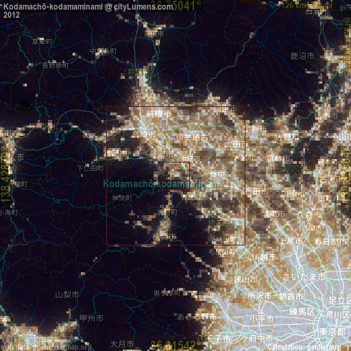
» Earth at Night: Flat Maps 2012, 2016