Tamamura night lights from space
Night Light of Tamamura (Gunma) from space (Japan) Src. Average luminocity for 10x10km area is 65.2028% and for 50x50km: 34.1204%.
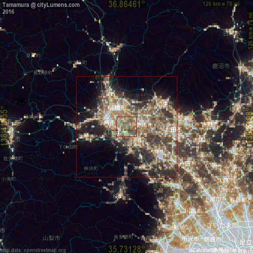
Analysis of Tamamura night lights 2016
Square area 10x10 km:
 3.85%
3.85%90-99
12.06%80-89
8.22%70-79
9.79%60-69
18.53%50-59
29.02%40-49
12.06%30-39
6.47%20-29
0%10-19
0%0-9
0%Square area 50x50 km:
2.41%90-99
5.99%80-89
4.42%70-79
4.88%60-69
6.62%50-59
7.91%40-49
7.73%30-39
7.43%20-29
7.82%10-19
10.57%0-9
34.22%Clear (daylight) street map image can be seen on geolist.org.
Map coordinates:
36° 51' 52.6" North, 138° 24' 48.8" East
36° 18' 0" North, 139° 7' 0" East
35° 43' 52.6" North, 139° 49' 11.3" East
Some cities around Tamamura sort by population:
• Maebashi
11.5 km =7.1 mi,  344°
344°
• Takasaki
9.7 km =6 mi,  292°
292°
• Isesaki
7.7 km =4.8 mi,  76°
76°
• Fujioka
7.2 km =4.5 mi,  213°
213°
• Honjō
9.6 km =6 mi,  136°
136°
• Sakai-nakajima
12.5 km =7.8 mi,  107°
107°
• Yoshii
13.2 km =8.2 mi,  245°
245°
• Kodamachō-kodamaminami
12.9 km =8 mi,  173°
173°
1850746 (p: 42,566)
Sources (retrieved 2019-11-25):
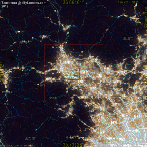
» Earth at Night: Flat Maps 2012, 2016