Yoshii night lights from space
Night Light of Yoshii (Gunma) from space (Japan) Src. Average luminocity for 10x10km area is 20.1521% and for 50x50km: 23.5879%.
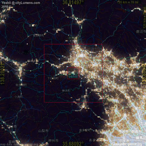
Analysis of Yoshii night lights 2016
Square area 10x10 km:
 0%
0%90-99
0.7%80-89
2.1%70-79
0%60-69
1.57%50-59
3.15%40-49
4.72%30-39
6.64%20-29
19.76%10-19
27.62%0-9
33.74%Square area 50x50 km:
1.43%90-99
4.13%80-89
2.88%70-79
3.31%60-69
4.95%50-59
5.46%40-49
4.5%30-39
4.51%20-29
6.09%10-19
9.39%0-9
53.36%Clear (daylight) street map image can be seen on geolist.org.
Map coordinates:
36° 48' 53.9" North, 138° 16' 48.8" East
36° 15' 0" North, 138° 58' 60" East
35° 40' 51.3" North, 139° 41' 11.3" East
Some cities around Yoshii sort by population:
• Takasaki
9.7 km =6 mi,  17°
17°
• Fujioka
8 km =5 mi,  93°
93°
• Honjō
18.6 km =11.6 mi, 94°
• Tomioka
7.7 km =4.8 mi,  273°
273°
• Annaka
11.9 km =7.4 mi,  318°
318°
• Tamamura
13.2 km =8.2 mi,  65°
65°
• Kanekomachi
17.9 km =11.1 mi,  3°
3°
• Kodamachō-kodamaminami
15.2 km =9.4 mi,  118°
118°
1848194 (p: 25,655)
Sources (retrieved 2019-11-25):
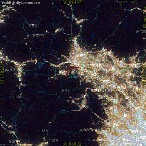
» Earth at Night: Flat Maps 2012, 2016