Takahata night lights from space
Night Light of Takahata (Yamagata) from space (Japan) Src. Average luminocity for 10x10km area is 7.8555% and for 50x50km: 4.6486%.
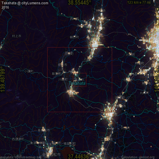
Analysis of Takahata night lights 2016
Square area 10x10 km:
 0%
0%90-99
0.81%80-89
1.14%70-79
0.65%60-69
0.65%50-59
0%40-49
2.76%30-39
2.76%20-29
3.41%10-19
1.46%0-9
86.36%Square area 50x50 km:
0.17%90-99
0.35%80-89
0.56%70-79
0.54%60-69
0.76%50-59
0.86%40-49
1.15%30-39
0.79%20-29
1.77%10-19
3.45%0-9
89.61%Clear (daylight) street map image can be seen on geolist.org.
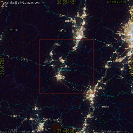
Map coordinates:
38° 33' 16" North, 139° 29' 16.8" East
38° 0' 9" North, 140° 11' 28" East
37° 26' 46.9" North, 140° 53' 39.3" East
Some cities around Takahata sort by population:
• Fukushima
37.1 km =23.1 mi,  139°
139°
• Yamagata
29.9 km =18.6 mi,  30°
30°
• Yonezawa
12.2 km =7.6 mi,  212°
212°
• Shiroishi
37.4 km =23.2 mi,  89°
89°
• Kaminoyama
18.3 km =11.4 mi,  23°
23°
• Nagai
17.7 km =11 mi,  309°
309°
• Hobaramachi
37.7 km =23.4 mi,  123°
123°
• Yanagawamachi-saiwaichō
39.7 km =24.7 mi, 115°
2110891 (p: 26,347)
Sources (retrieved 2019-11-25):
» Earth at Night: Flat Maps 2012, 2016