Sano night lights from space
Night Light of Sano (Tochigi) from space (Japan) Src. Average luminocity for 10x10km area is 55.1678% and for 50x50km: 37.0501%.
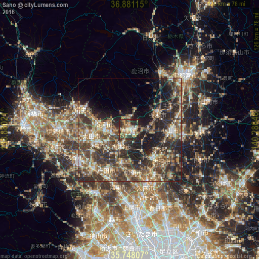
Analysis of Sano night lights 2016
Square area 10x10 km:
 4.72%
4.72%90-99
10.49%80-89
8.39%70-79
11.19%60-69
10.66%50-59
7.69%40-49
8.74%30-39
11.36%20-29
22.9%10-19
3.85%0-9
0%Square area 50x50 km:
2.16%90-99
6.16%80-89
4.55%70-79
4.96%60-69
6.4%50-59
7.79%40-49
9.86%30-39
10.19%20-29
12.8%10-19
12.48%0-9
22.65%Clear (daylight) street map image can be seen on geolist.org.
Map coordinates:
36° 52' 52.1" North, 138° 52' 48.8" East
36° 19' 0" North, 139° 34' 60" East
35° 44' 53.1" North, 140° 17' 11.3" East
Some cities around Sano sort by population:
• Oyama
19.5 km =12.1 mi,  95°
95°
• Ashikaga
12.1 km =7.5 mi,  278°
278°
• Tochigi
15.3 km =9.5 mi,  61°
61°
• Tatebayashi
8.7 km =5.4 mi,  211°
211°
• Hanyū
17.3 km =10.7 mi,  195°
195°
• Koga
19 km =11.8 mi,  141°
141°
• Tanuma
5.6 km =3.5 mi,  0°
0°
• Fujioka
9.5 km =5.9 mi, 141°
1852964 (p: 82,535)
Sources (retrieved 2019-11-25):
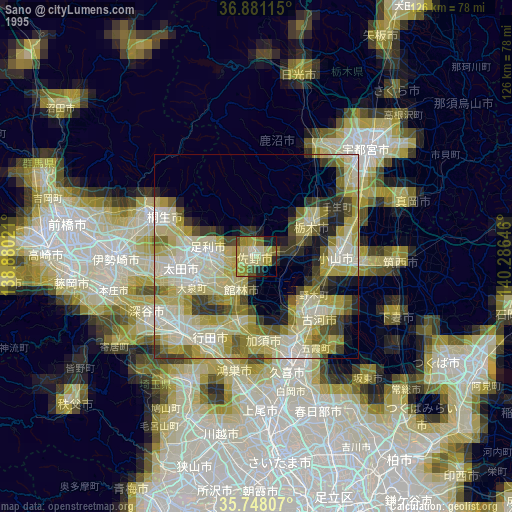
» NASA, Earths city lights 1995
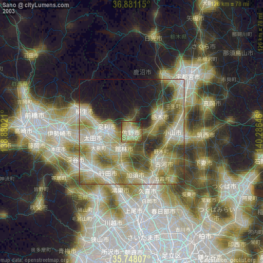
» NASA city lights 2003
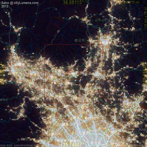
» Earth at Night: Flat Maps 2012, 2016