Tanuma night lights from space
Night Light of Tanuma (Tochigi) from space (Japan) Src. Average luminocity for 10x10km area is 37.278% and for 50x50km: 32.658%.
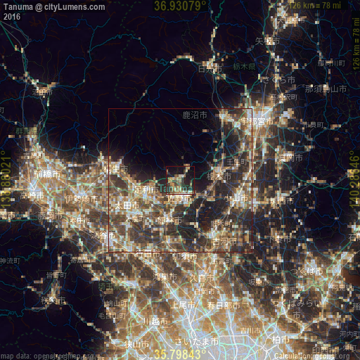
Analysis of Tanuma night lights 2016
Square area 10x10 km:
100  1.05%
1.05%
90-99 5.77%
80-89 4.2%
70-79 5.94%
60-69 8.57%
50-59 6.82%
40-49 6.64%
30-39 7.17%
20-29 15.03%
10-19 24.65%
0-9 14.16%
1.05%90-99
5.77%80-89
4.2%70-79
5.94%60-69
8.57%50-59
6.82%40-49
6.64%30-39
7.17%20-29
15.03%10-19
24.65%0-9
14.16%Square area 50x50 km:
100 2.02%
90-99 5.58%
80-89 3.99%
70-79 4.32%
60-69 5.49%
50-59 6.42%
40-49 8.53%
30-39 8.49%
20-29 11.75%
10-19 12.41%
0-9 31.01%
2.02%90-99
5.58%80-89
3.99%70-79
4.32%60-69
5.49%50-59
6.42%40-49
8.53%30-39
8.49%20-29
11.75%10-19
12.41%0-9
31.01%Clear (daylight) street map image can be seen on geolist.org.
Map coordinates:
36° 55' 50.8" North, 138° 52' 48.8" East
36° 22' 0" North, 139° 34' 60" East
35° 47' 54.3" North, 140° 17' 11.3" East
Some cities around Tanuma sort by population:
• Oyama
20.8 km =12.9 mi,  110°
110°
• Ashikaga
12.5 km =7.8 mi,  252°
252°
• Ōta
20.8 km =12.9 mi, 249°
• Sano
5.6 km =3.5 mi,  180°
180°
• Tochigi
13.6 km =8.5 mi,  82°
82°
• Tatebayashi
13.7 km =8.5 mi,  199°
199°
• Mibu
20.2 km =12.6 mi,  74°
74°
• Fujioka
14.3 km =8.9 mi,  155°
155°
1850630 (p: 28,723)
Sources (retrieved 2019-11-25):
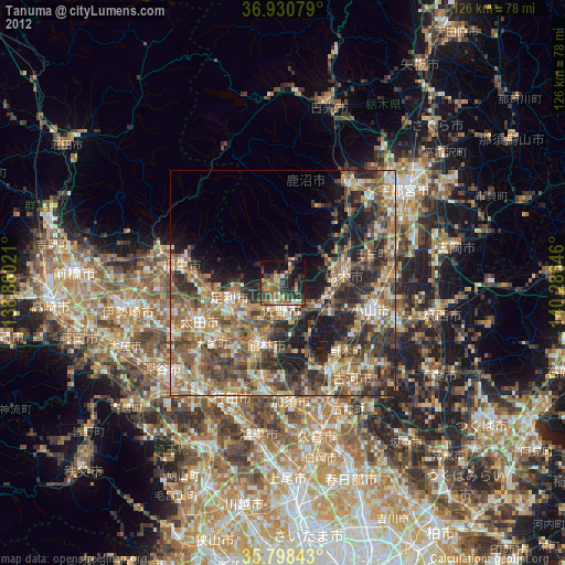
» Earth at Night: Flat Maps 2012, 2016