Ōarai night lights from space
Night Light of Ōarai (Ibaraki) from space (Japan) Src. Average luminocity for 10x10km area is 24.8024% and for 50x50km: 14.2738%.
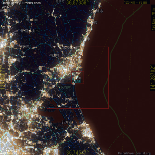
Analysis of Ōarai night lights 2016
Square area 10x10 km:
 0.87%
0.87%90-99
3.32%80-89
3.5%70-79
3.15%60-69
2.45%50-59
4.9%40-49
4.55%30-39
5.59%20-29
12.59%10-19
18.36%0-9
40.73%Square area 50x50 km:
0.99%90-99
1.89%80-89
1.56%70-79
1.73%60-69
2.34%50-59
3.17%40-49
2.83%30-39
2.82%20-29
5.05%10-19
9.67%0-9
67.94%Clear (daylight) street map image can be seen on geolist.org.
Map coordinates:
36° 52' 42.9" North, 139° 52' 50.8" East
36° 18' 50.7" North, 140° 35' 2" East
35° 44' 43.7" North, 141° 17' 13.3" East
Some cities around Ōarai sort by population:
• Mito
12.6 km =7.8 mi,  288°
288°
• Hitachi-Naka
10.2 km =6.3 mi,  334°
334°
• Katsuta
8.9 km =5.5 mi, 329°
• Tomobe
25.7 km =16 mi,  278°
278°
• Funaishikawa
17 km =10.6 mi,  354°
354°
• Okunoya
15.4 km =9.6 mi,  257°
257°
• Kasama
29.4 km =18.3 mi, 285°
• Ōmiya
30.2 km =18.8 mi, 330°
2111567 (p: 19,326)
Sources (retrieved 2019-11-25):
» Earth at Night: Flat Maps 2012, 2016