Nirasaki night lights from space
Night Light of Nirasaki (Yamanashi) from space (Japan) Src. Average luminocity for 10x10km area is 23.0787% and for 50x50km: 8.5426%.

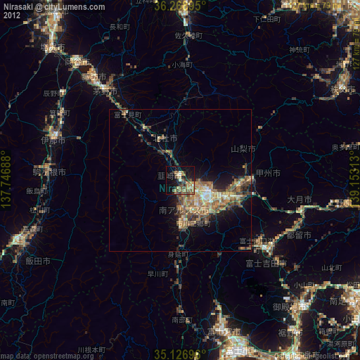
Analysis of Nirasaki night lights 2016
Square area 10x10 km:
 0.87%
0.87%90-99
1.92%80-89
4.02%70-79
1.75%60-69
2.8%50-59
7.34%40-49
5.07%30-39
5.07%20-29
6.64%10-19
16.96%0-9
47.55%Square area 50x50 km:
0.53%90-99
1.34%80-89
1.05%70-79
1.05%60-69
0.97%50-59
1.94%40-49
2.12%30-39
1.72%20-29
2.56%10-19
4.82%0-9
81.9%Clear (daylight) street map image can be seen on geolist.org.
Map coordinates:
36° 16' 8.2" North, 137° 44' 48.8" East
35° 42' 0" North, 138° 27' 0" East
35° 7' 37.1" North, 139° 9' 11.3" East
Some cities around Nirasaki sort by population:
• Kōfu
11.2 km =7 mi,  109°
109°
• Chino
42.2 km =26.2 mi,  320°
320°
• Fujiyoshida
42.6 km =26.5 mi,  132°
132°
• Hokuto
15.7 km =9.8 mi,  341°
341°
• Ryūō
7.2 km =4.5 mi,  140°
140°
• Isawa
17.5 km =10.9 mi, 108°
• Enzan
25.6 km =15.9 mi,  90°
90°
• Fujikawaguchiko
31.8 km =19.8 mi, 137°
1855363 (p: 33,263)
Sources (retrieved 2019-11-25):
» Earth at Night: Flat Maps 2012, 2016