Chino night lights from space
Night Light of Chino (Nagano) from space (Japan) Src. Average luminocity for 10x10km area is 25.3993% and for 50x50km: 6.2989%.
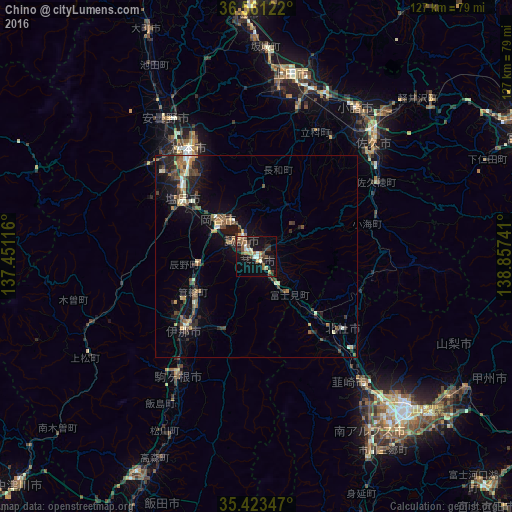
Analysis of Chino night lights 2016
Square area 10x10 km:
 2.01%
2.01%90-99
3.11%80-89
3.11%70-79
2.56%60-69
3.85%50-59
4.58%40-49
5.13%30-39
4.76%20-29
5.49%10-19
26.74%0-9
38.64%Square area 50x50 km:
0.27%90-99
0.71%80-89
0.68%70-79
0.56%60-69
1.04%50-59
1.03%40-49
1.46%30-39
1.17%20-29
1.97%10-19
4.96%0-9
86.15%Clear (daylight) street map image can be seen on geolist.org.
Map coordinates:
36° 33' 40.4" North, 137° 27' 4.2" East
35° 59' 39.8" North, 138° 9' 15.4" East
35° 25' 24.5" North, 138° 51' 26.7" East
Some cities around Chino sort by population:
• Matsumoto
31.5 km =19.6 mi,  327°
327°
• Shiojiri
20.6 km =12.8 mi,  304°
304°
• Ina
25.9 km =16.1 mi,  224°
224°
• Suwa
6.1 km =3.8 mi,  322°
322°
• Okaya
12 km =7.5 mi,  305°
305°
• Hokuto
28.1 km =17.5 mi,  129°
129°
• Kamimaruko
37.6 km =23.4 mi,  16°
16°
• Tatsuno
14.2 km =8.8 mi,  265°
265°
1864557 (p: 56,567)
Sources (retrieved 2019-11-25):
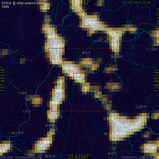
» NASA, Earths city lights 1995
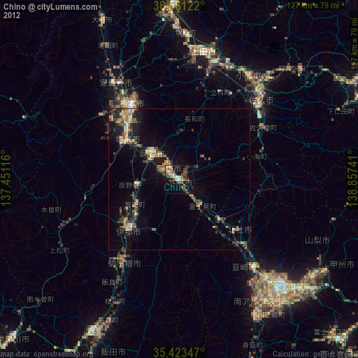
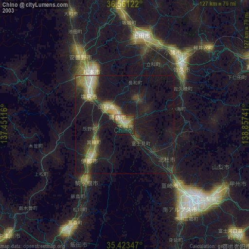
» NASA city lights 2003
» Earth at Night: Flat Maps 2012, 2016