Isawa night lights from space
Night Light of Isawa (Yamanashi) from space (Japan) Src. Average luminocity for 10x10km area is 48.0017% and for 50x50km: 9.7879%.
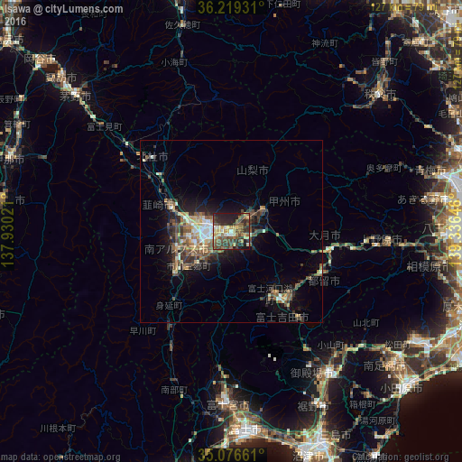
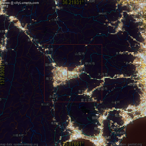
Analysis of Isawa night lights 2016
Square area 10x10 km:
 1.57%
1.57%90-99
5.94%80-89
8.74%70-79
6.47%60-69
5.77%50-59
12.76%40-49
15.91%30-39
13.46%20-29
16.78%10-19
12.59%0-9
0%Square area 50x50 km:
0.58%90-99
1.44%80-89
1.15%70-79
1.17%60-69
1.09%50-59
2.32%40-49
2.38%30-39
1.96%20-29
2.85%10-19
5.37%0-9
79.68%Clear (daylight) street map image can be seen on geolist.org.
Map coordinates:
36° 13' 9.5" North, 137° 55' 48.8" East
35° 39' 0" North, 138° 37' 60" East
35° 4' 35.8" North, 139° 20' 11.3" East
Some cities around Isawa sort by population:
• Kōfu
6.3 km =3.9 mi,  287°
287°
• Fujiyoshida
27.6 km =17.1 mi,  147°
147°
• Hokuto
29.7 km =18.5 mi,  313°
313°
• Ryūō
12 km =7.5 mi,  270°
270°
• Nirasaki
17.5 km =10.9 mi, 288°
• Ōtsuki
31 km =19.3 mi,  96°
96°
• Enzan
10.6 km =6.6 mi,  58°
58°
• Fujikawaguchiko
18.5 km =11.5 mi,  164°
164°
1861454 (p: 29,616)
Sources (retrieved 2019-11-25):
» Earth at Night: Flat Maps 2012, 2016