Machida night lights from space
Night Light of Machida (Tokyo) from space (Japan) Src. Average luminocity for 10x10km area is 97.0037% and for 50x50km: 76.6817%.
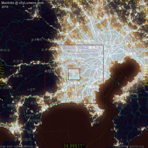
Analysis of Machida night lights 2016
Square area 10x10 km:
 48.53%
90-99
39.74%80-89
9.71%70-79
2.01%60-69
0%50-59
0%40-49
0%30-39
0%20-29
0%10-19
0%0-9
0%Square area 50x50 km:
38.95%90-99
20.41%80-89
7.65%70-79
4.92%60-69
3.84%50-59
2.21%40-49
2.73%30-39
3.23%20-29
3.8%10-19
3.93%0-9
8.33%Clear (daylight) street map image can be seen on geolist.org.
Map coordinates:
36° 6' 37.3" North, 138° 44' 51.8" East
35° 32' 25" North, 139° 27' 3" East
34° 57' 58" North, 140° 9' 14.3" East
Some cities around Machida sort by population:
• Hachiōji
17.2 km =10.7 mi,  318°
318°
• Atsugi
13.1 km =8.1 mi,  214°
214°
• Minamirinkan
5.1 km =3.2 mi,  188°
188°
• Chōfu
15.9 km =9.9 mi,  33°
33°
• Kamirenjaku
19.5 km =12.1 mi, 28°
• Hino
15.5 km =9.6 mi,  342°
342°
• Zama
8 km =5 mi,  222°
222°
• Kokubunji
18.1 km =11.2 mi,  7°
7°
1857871 (p: 399,969)
Sources (retrieved 2019-11-25):
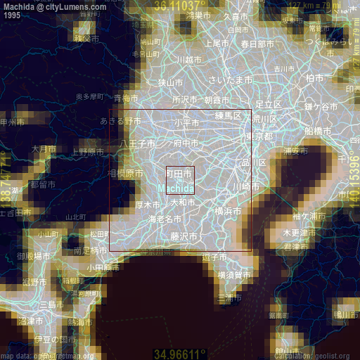
» NASA, Earths city lights 1995
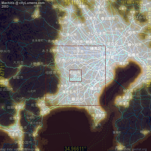
» NASA city lights 2003
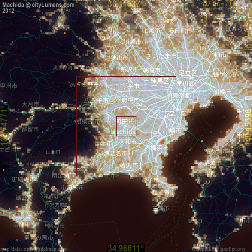
» Earth at Night: Flat Maps 2012, 2016