Chōfu night lights from space
Night Light of Chōfu (Tokyo) from space (Japan) Src. Average luminocity for 10x10km area is 99.0944% and for 50x50km: 88.9932%.
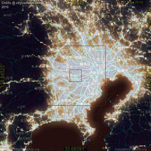

Analysis of Chōfu night lights 2016
Square area 10x10 km:
 79.02%
90-99
18.18%80-89
2.1%70-79
0.7%60-69
0%50-59
0%40-49
0%30-39
0%20-29
0%10-19
0%0-9
0%Square area 50x50 km:
51.18%90-99
22.71%80-89
7.35%70-79
5.09%60-69
3.95%50-59
1.96%40-49
1.77%30-39
1.76%20-29
1.8%10-19
1.53%0-9
0.91%Clear (daylight) street map image can be seen on geolist.org.
Map coordinates:
36° 13' 42.5" North, 138° 50' 42.9" East
35° 39' 33.3" North, 139° 32' 54.1" East
35° 5' 9.3" North, 140° 15' 5.4" East
Some cities around Chōfu sort by population:
• Tokyo
13.4 km =8.3 mi,  75°
75°
• Nishi-Tokyo-shi
7.4 km =4.6 mi,  352°
352°
• Kamirenjaku
3.9 km =2.4 mi,  8°
8°
• Hino
13.5 km =8.4 mi,  276°
276°
• Higashimurayama
12.8 km =8 mi,  325°
325°
• Musashino
5.3 km =3.3 mi, 10°
• Kokubunji
8.1 km =5 mi,  306°
306°
• Tanashichō
7.8 km =4.8 mi, 353°
1864518 (p: 212,977)
Sources (retrieved 2019-11-25):
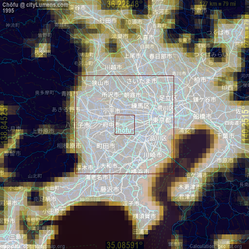
» NASA, Earths city lights 1995
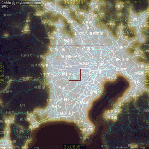
» NASA city lights 2003
» Earth at Night: Flat Maps 2012, 2016