Kamirenjaku night lights from space
Night Light of Kamirenjaku (Tokyo) from space (Japan) Src. Average luminocity for 10x10km area is 99.4108% and for 50x50km: 89.3718%.
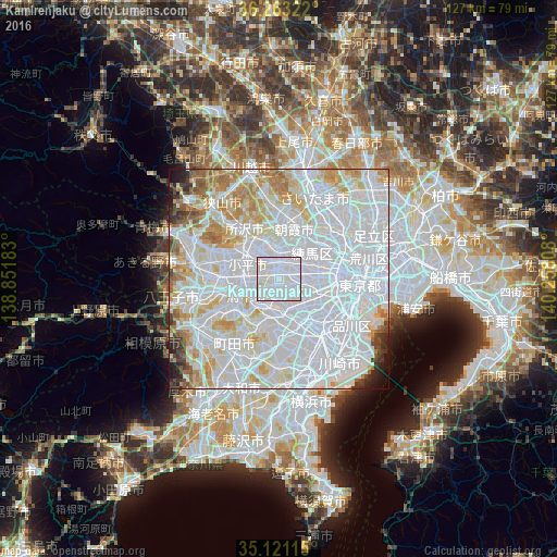

Analysis of Kamirenjaku night lights 2016
Square area 10x10 km:
 83.74%
90-99
14.86%80-89
1.4%70-79
0%60-69
0%50-59
0%40-49
0%30-39
0%20-29
0%10-19
0%0-9
0%Square area 50x50 km:
50.62%90-99
22.08%80-89
7.44%70-79
6.2%60-69
5.18%50-59
2.19%40-49
1.58%30-39
1.57%20-29
1.6%10-19
1.24%0-9
0.3%Clear (daylight) street map image can be seen on geolist.org.
Map coordinates:
36° 15' 47.6" North, 138° 51' 6.6" East
35° 41' 39.2" North, 139° 33' 17.8" East
35° 7' 16.1" North, 140° 15' 29.1" East
Some cities around Kamirenjaku sort by population:
• Tokyo
12.4 km =7.7 mi,  92°
92°
• Chōfu
3.9 km =2.4 mi,  188°
188°
• Nishi-Tokyo-shi
3.8 km =2.4 mi,  336°
336°
• Higashimurayama
10.3 km =6.4 mi,  310°
310°
• Musashino
1.4 km =0.9 mi,  17°
17°
• Kokubunji
7.2 km =4.5 mi,  277°
277°
• Tanashichō
4.2 km =2.6 mi, 338°
• Wako
12.3 km =7.6 mi,  30°
30°
1860437 (p: 178,739)
Sources (retrieved 2019-11-25):
» NASA, Earths city lights 1995
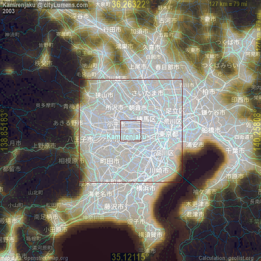
» NASA city lights 2003
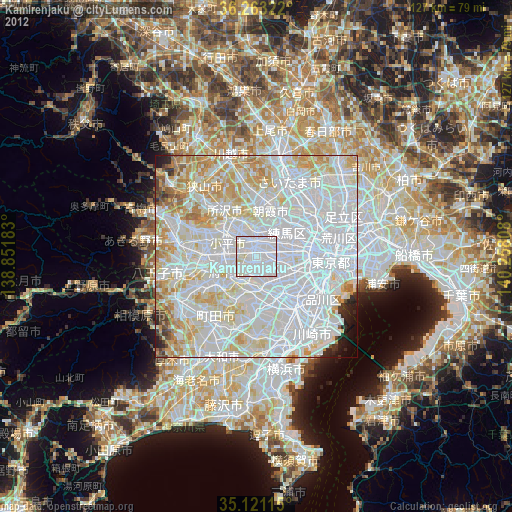
» Earth at Night: Flat Maps 2012, 2016